8/04/2024 - 8/10/2024
Climate in the News:
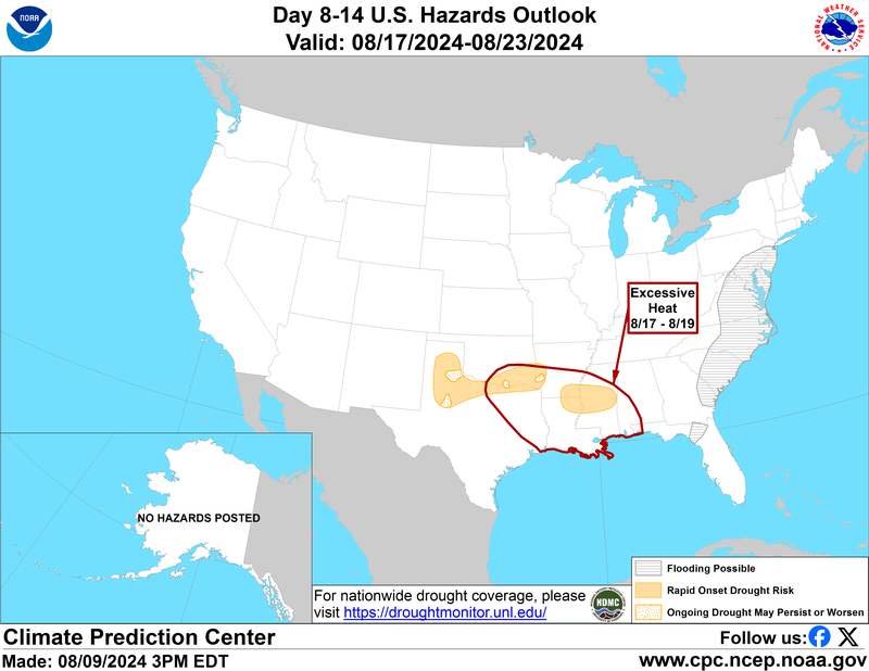
The August heat has been no joke for the Southern Region. With high temperatures and low topsoil moisture almost half of Oklahoma is experiencing drought conditions. With more excessive heat and below-normal amounts of rainfall in the forecast the Climate Prediction Center has outlined southeastern Oklahoma and the Texas Panhandle in a Rapid Onset Drought Risk, or Flash Drought Risk. The Wichita Falls area of Texas has been at risk for flash drought for much of the month now, but with drying topsoil in central Mississippi, that area is now also at risk. Keep up with drought in the Southern Region by reading our weekly drought updates which come out on our website every Thursday.
Weather Synopsis:
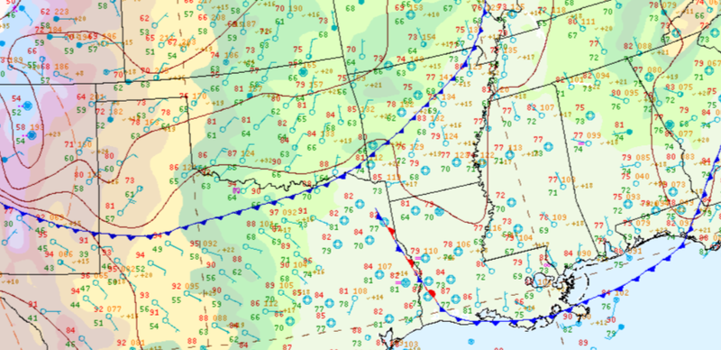
The weather was quiet to start the week as a high-pressure system sat over the region bringing hot temperatures and sunny skies. By the end of the week though, a cold front had made it into North Texas and central Arkansas bringing cooler and drier days for the northern portions of the Region.
Temperature:
Overall, summer days in August are hot across most of the region. High humidity levels are present near the coast due to the prevailing southerly winds that bring moisture from the Gulf of Mexico.
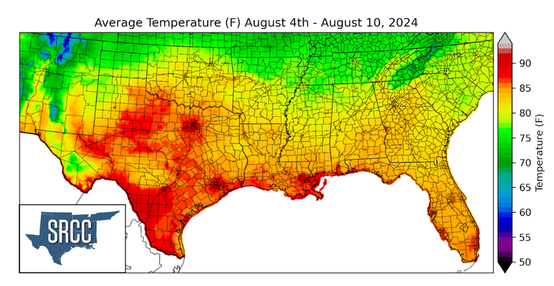
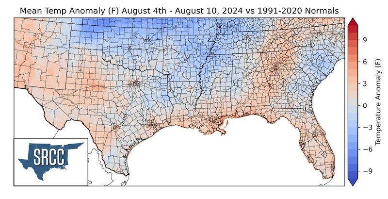
Temperatures were quite warm last week across the Southern Region, and hot in Texas as a high pressure system sat over the state for much of the week. This resulted in a weekly average temperature for the state at about 85 degrees Fahrenheit. Due to the strong late week cold front discussed above, the northern portions of the region saw below-normal temperature anomalies for the week. While the more southern portions and West Texas saw weekly average temperature just above normal. Overall average temperatures for the week ranged between 76 and 70 degrees Fahrenheit.
Precipitation:
With the majority of the region being in a humid subtropical climate, rainfall is common at any point of the year. Frequently, during the summer months, sea breezes initiate thunderstorms and rain showers, which are quite common along the coastal areas.
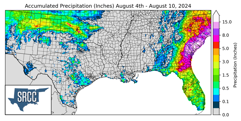
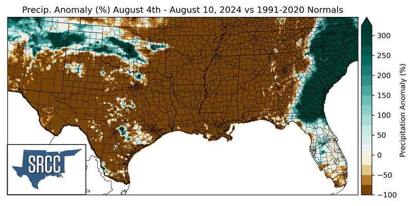
The Southern Region was very dry last week with small amounts of rain occurring in southeast Texas from sea-breeze-initiated showers and some more substantial showers and thunderstorms in the Texas Panhandle and western Oklahoma. The highest weekly precipitation totals occurred in Dewey and Cleveland Counties in Oklahoma where eight inches of rainfall was recorded. On August 11th, a CoCoRaHS report out of Cleveland County reported almost 10 inches of rain. Overall though, many areas remained dry this week.
