5/12/2024 - 5/18/2024
Climate in the News:
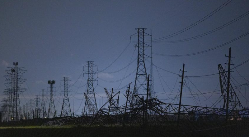
Hurricane season is fast approaching in the Gulf States, but this past Thursday it was not a hurricane that brought 100 mph winds to the Houston area. It was a derecho. The American Meteorological Society defines a derecho as “a widespread convectively induced straightline windstorm”, simply put and in this case, it was a thunderstorm with particularly strong and damaging winds. This storm caused extensive damage to buildings, highrises, and especially power lines in Harris County. As a result of this storm over 40% of Harris County was without power Thursday night. That number has improved but damage to the power lines was so substantial that many will remain without power for another 2-4 weeks. Unfortunately, that is not the only damage this storm has caused, it also dropped an EF-1 tornado in Cypress, TX, northwest of Houston. Thus far there have been four confirmed fatalities due to the high straight-line winds of this storm. It is important to follow the necessary precautions in warnings issued by the National Weather Service.
Weather Synopsis:
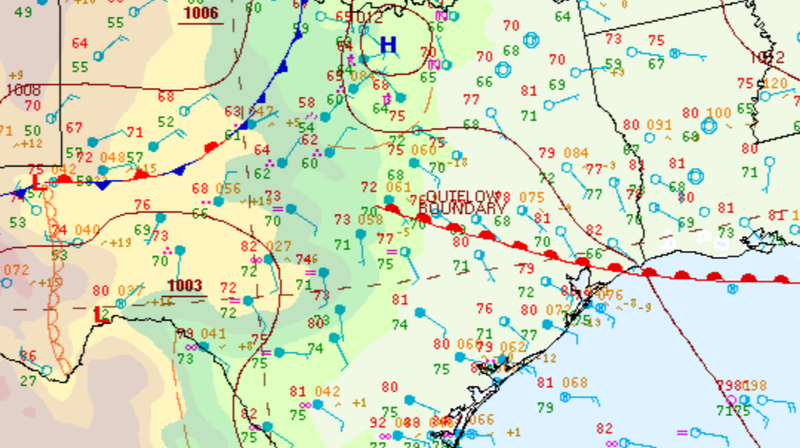
Storms ongoing from Wednesday night carried into Thursday morning. These storms continued to develop in Central Texas as the remnant storms outflow boundary interacted with the northward propagating warm front. As the day progressed these storms strengthened and organized into a line as it approached the Houston area, leading to Thursday’s derecho.
Temperature:
Generally, May is when the Region starts to see consistently warmer temperatures. Temperatures in the southern portions of the Region often start seeing daily average temperatures in the low 80’s.
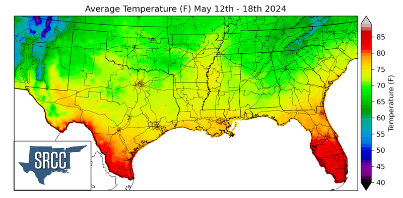
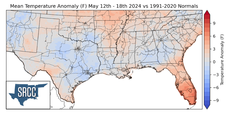
Temperatures were warm to mild last week across the Southern Region thanks to cloud cover and several weak cold fronts. Therefore, some areas were able to see below-normal and near-normal temperatures making the May heat more tolerable. Slightly above-normal temperatures were felt as well, most notably in Arkansas, Tennessee, and Mississippi. Despite weekly average temperatures only slightly above normal in Deep South Texas, Brownsville, TX was still able to set a record daily high temperature at 95°F. Overall average temperatures for the week ranged between 76 and 70 degrees Fahrenheit.
Precipitation:
With the majority of the Region being in a humid subtropical climate, rainfall is common at any point of the year. During the spring months, storm systems are common throughout the southern portions of the Region. During May severe storm probabilities are at their highest in Oklahoma and Northeast Texas in the Southern Region.
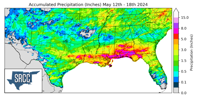
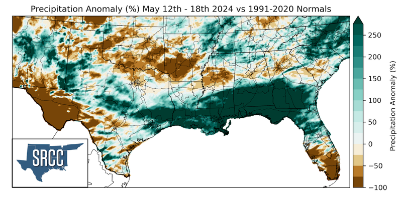
The work week began with a powerful storm system making its way from east Texas into Mississippi. While this storm moved through Louisiana it brought flash flooding, strong winds, and an EF-3 tornado to Sulphur, Louisiana. Storms continued to fire along the dryline in West Texas throughout the week bringing rain to Central Texas. Before Thursday’s storm made it to Houston, it provided ongoing rain for several hours in the Brazos Valley. With already saturated soils from previous rain events, flooding occurred quickly with creeks/rivers overflowing and roads flooding. This resulted in several high-water rescues. A new daily rainfall record was set at Easterwood Airport in College Station, TX Thursday at 3.34 inches. This storm system continued into Louisiana and Mississippi and led to more flooding and flash flooding. Weekly rainfall totals reached as high as 8 inches northeast of Houston and in areas along the southern portions of Louisiana and Mississippi. With multiple heavy rainfall events seemingly back to back, flooding is still ongoing in East Texas in the following rivers: Trinity, Neches, Navastota, and Sabine.
