5/05/2024 - 5/11/2024
Climate in the News:
Last week was yet another week of active weather for the Southern Region. On Wednesday conditions were very favorable for thunderstorm development in Tennessee. Storms formed through the late afternoon and evening eventually organizing into a line of thunderstorms. Several tornadoes touched down in central Tennessee that evening. Most notable was the EF-3 tornado in Columbia, Tennessee, which damaged homes and unfortunately took the life of one person, also injuring 12. As severe weather is ever so common in the Region this late spring it is important to have multiple ways to receive watches and warnings.

Weather Synopsis:
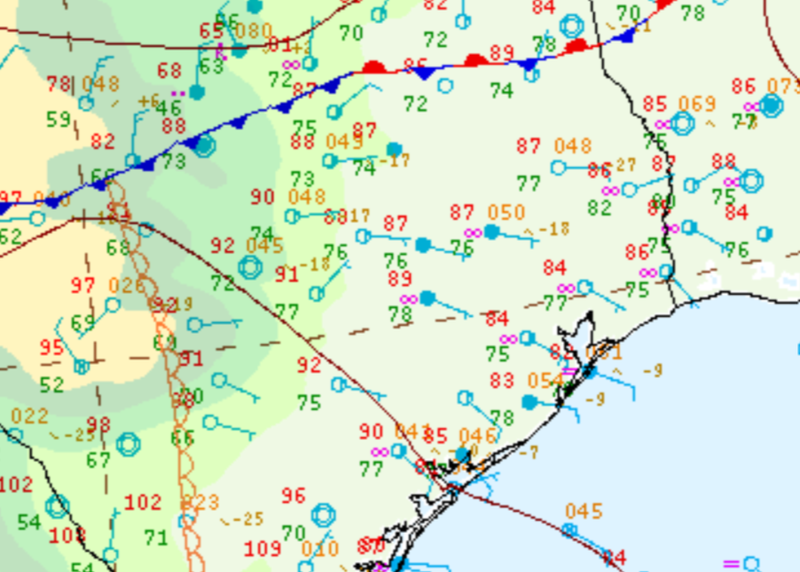
Additional storm development occurred in Central Texas on Thursday as well. As storms fired along the dryline in the Hill Country conditions for large hail were present. Large amounts of atmospheric instability, in this case, aided by warm surface temperatures, helped produce very large hail. In Blanco County, Texas a 6.25 inch in diameter hailstone was reported, one of the biggest to ever be recorded in the state!
Temperature:
Generally, May is when the Region starts to see consistently warmer temperatures. Temperatures in the southern portions of the Region often start seeing daily average temperatures in the low 80’s.
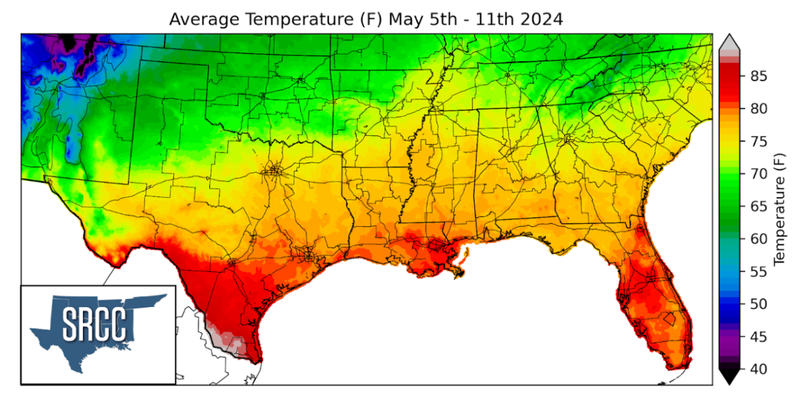
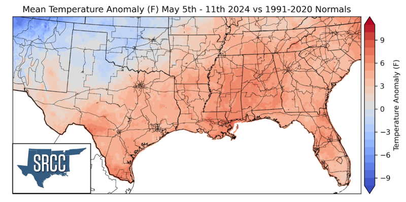
Temperatures were warm for much of the Southern Region last week. Temperatures were above normal for the whole Region with the exception of the Texas Panhandle and Oklahoma, where temperatures favored near to slightly below normal. The highest departures were felt in eastern Mississippi, southeast Louisiana, and Deep South Texas where temperatures were 5 to 7 degrees above normal. Deep South Texas saw some extraordinary heat last week breaking records in multiple cities. Temperatures reached over 105°F in McAllen and Harlingen Texas on May 9th, breaking the monthly high temperature. Heat indices, which account for moisture, soared into the 120’s at multiple stations, smashing previous records. Thankfully, the entire Region did not see temperatures so miserable, and overall weekly average temperatures for the region ranged between 82 to 67 degrees Fahrenheit.
Precipitation:
With the majority of the Region being in a humid subtropical climate, rainfall is common at any point of the year. During the spring months, storm systems are common throughout the south. During May severe storm probabilities are at their highest in Oklahoma and Northeast Texas in the Southern Region.
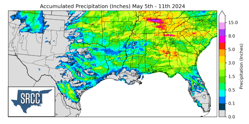
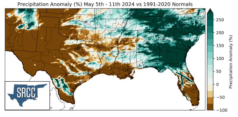
Several storm systems dropped substantial amounts of rain across the Southern Region last week. Starting Monday as storms grew upscale overnight strong winds and flash flooding occurred throughout central Oklahoma into northwest Arkansas. Storms continued throughout the week as another strong system moved into Tennessee. Slow storm motions led to overflowing rivers/creeks and road closures. According to a CoCoRaHS report on May 9th, 9 inches of rain fell in Sumner County in northern Tennessee. Weekly precipitation totals north of Nashville, TN reached up to 11 inches.
