4/28/2024 - 5/04/2024
Climate in the News:
Flooding across Southeast Texas this past week led to several high water rescues and closed roads. Pictured below is the Navasota River, which has now flooded parts of Highway 30 and OSR Highway. This is only a small portion of the flooding that excessive rainfall caused. This led the Texas Governor to issue a Disaster Declaration for East Texas due to flooding, in order to provide support from state resources. It is important to emphasize that just one foot of moving water can move a car and a reminder to “turn around don’t drown.”

Weather Synopsis:
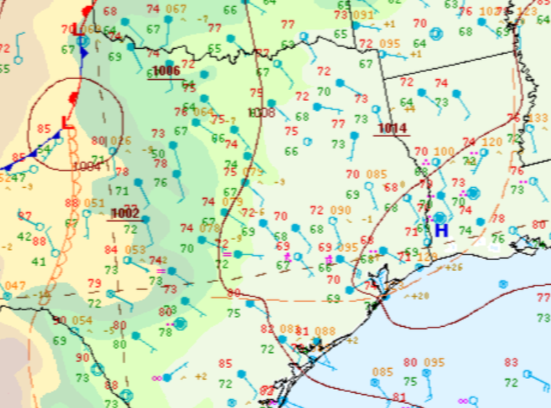
On Thursday storms initiated in the open warm sector in Southeast Texas. Storms continued to fire parallel to an existing outflow boundary. With storm motion parallel to the outflow boundary this led to prolonged rainfall in areas where previous flooding already existed.
Temperature:
Overall, May is when the Region starts to see consistently warmer temperatures. Temperatures in the southern portions of the Region often start seeing daily average temperatures in the low 80’s.
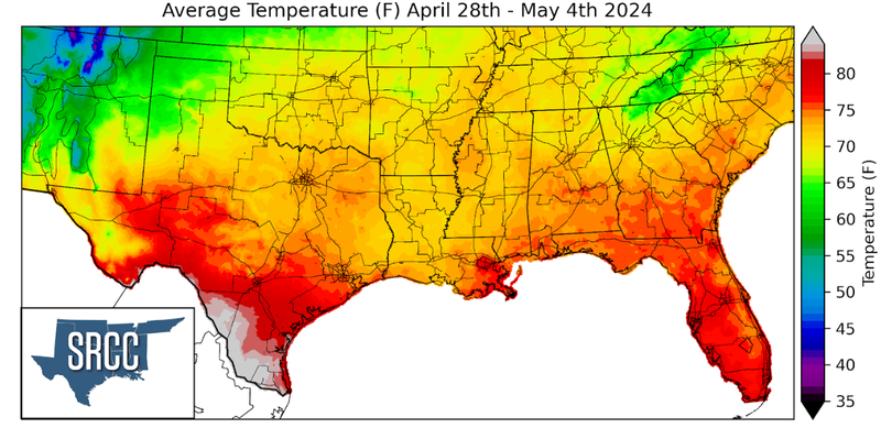
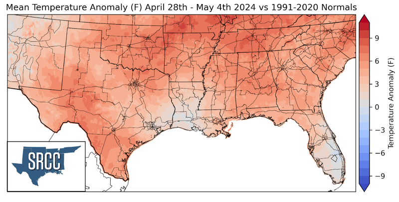
May brought with it warmer temperatures to the Southern Region. Temperatures were above normal for almost the entirety of the region with the expectation of central Louisiana where temperatures were near normal. The highest departures were felt in northwest Arkansas and the Nashville, TN area where temperatures were 7 to 8 degrees above normal. Overall average temperatures for the week ranged between 78 and 68 degrees Fahrenheit, with the lower bound being 8 degrees warmer than the week prior.
Precipitation:
With the majority of the Region being in a humid subtropical climate, rainfall is common at any point of the year. During the spring months, storm systems are common throughout the south. During May severe storm probabilities are at their highest in Oklahoma and Northeast Texas in the Southern Region.
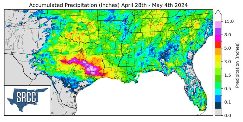
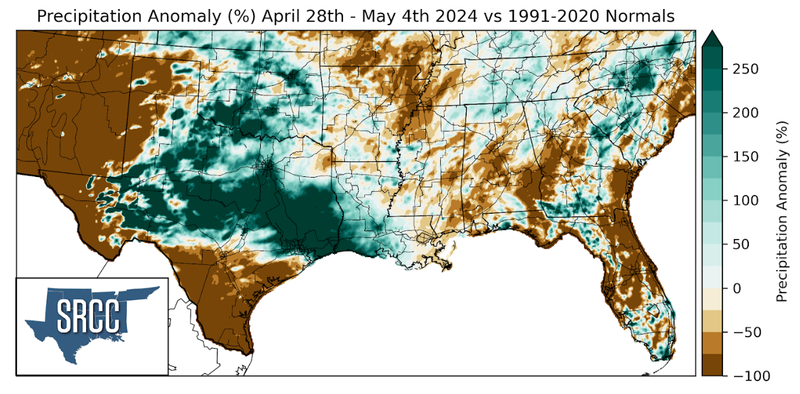
Last week proved very wet for western Louisiana, Oklahoma, and especially Texas. Several slow moving storm systems and stalled features led to several days of prolonged and heavy rainfall from Central Texas to southeast Texas. On April 29th alone, nearly 12 inches of rain fell in Trinity County, Texas according to a CoCoRaHS report. The Brazos Valley saw slightly smaller totals, near 8 inches, and still experienced catastrophic flooding. The rain let up for a couple days, but rivers and creeks remained high. Then, on May 2nd another round of rainfall made it to the Brazos Valley. According to a CoCoRaHS report a station in Walker County, Texas saw 12.5 inches of rain. This led to very dangerous road conditions near low lying areas, rivers, lakes, and creeks. Weekly rainfall totals reached as much as 15 inches in Walker County, Texas, just north of Houston. Totals throughout the entire Brazos Valley last week were a minimum of about 7 inches. Some areas farther west in the Hill Country also saw similar weekly accumulations.
