12/15/2024 - 12/21/2024
Climate in the News:
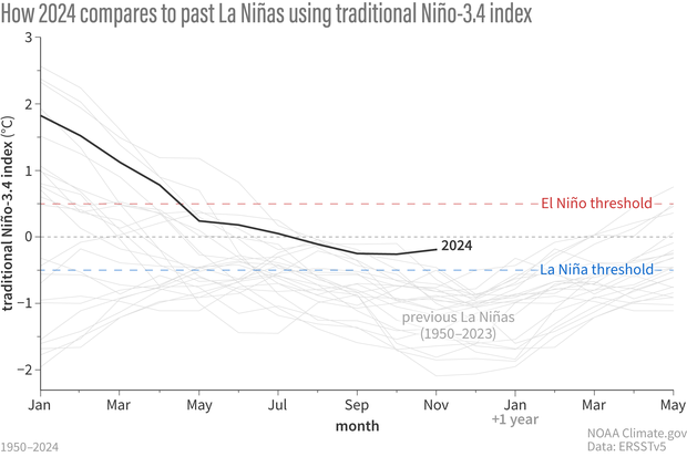
In the most recent update from NOAA’s Climate Prediction Center, there is about a 60% chance we will see La Niña conditions in the first half of next year. Currently, conditions are ENSO Neutral, and we see that this La Nina is taking much longer to emerge than the typical one. If this La Niña event emerges in the next year, it is forecasted to be much weaker than most La Niña events.
Weather Synopsis:
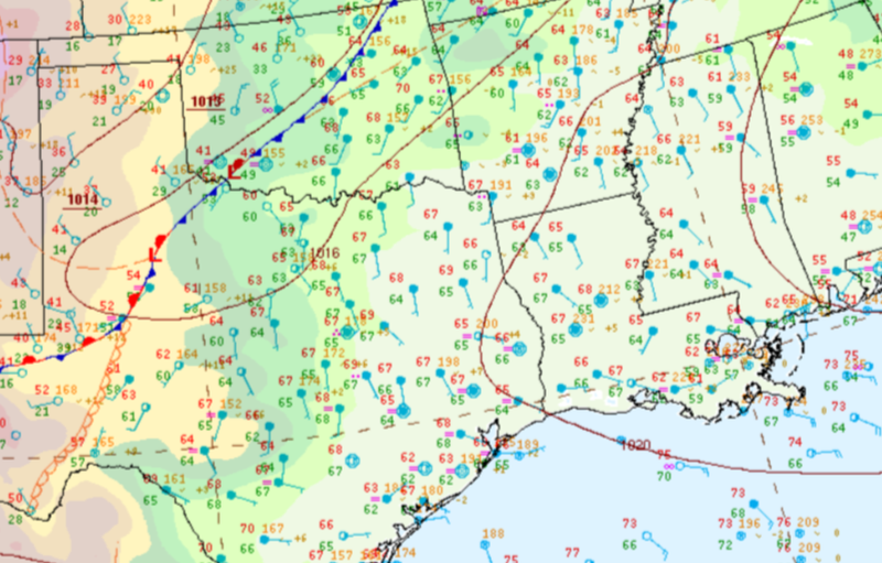
The air was warm and moist in much of the Southern Region ahead of a cold front on Monday. This environment was perfect for scattered showers and thunderstorms ahead of the front.
Temperature:
Overall, December is when most of the region starts to see cooler temperatures most of the time as the “cool” season begins. Frequent cold fronts bring with them colder air masses from the north, bringing freezing temperatures to the northern portions of the region.
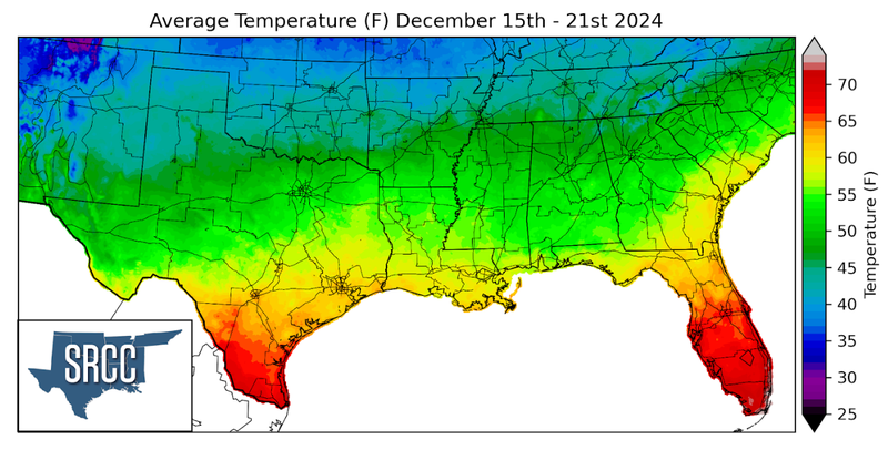
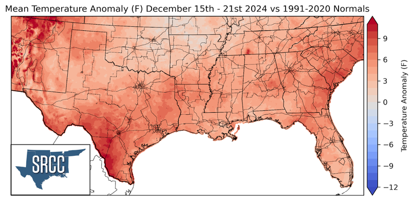
Temperatures were warm to begin the week, followed by a cold front, which cooled things down. This did not last for long though as temperatures quickly warmed back up. Across the Southern Region, weekly average temperatures were above average, and values ranged from as much as 72 degrees in Deep South Texas to 38 degrees in the Oklahoma Panhandle.
Precipitation:
With the majority of the region being in a humid subtropical climate, rainfall is common at any point of the year. Frequently, during the winter months, cold fronts bring with them showers, thunderstorms, and even frozen precipitation to the Texas Panhandle, Oklahoma, Arkansas, and Tennessee. The boundary between the cold and warm air masses serves as a trigger mechanism for storms.
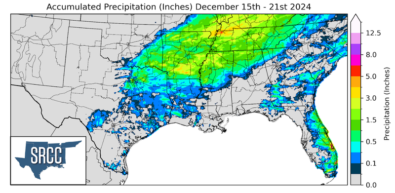
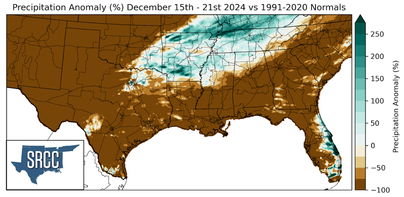
Precipitation was concentrated in the northeast portion of the Southern Region last week as storms ahead of the cold front brought steady precipitation to the area. Precipitation totals neared about 1.5 inches throughout the area.
