12/08/2024 - 12/14/2024
Climate in the News:
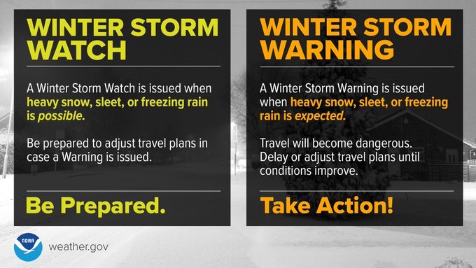
Last week was the Southern Plains winter weather preparedness week, so in that spirit we will share some helpful information to keep yourself safe during different winter weather hazards. It is imperative to follow and pay attention to the National Weather Service issued watches, warnings, and advisories and to act appropriately. A winter storm watch means hazardous conditions are possible and one should be prepared. A winter storm warning means hazardous conditions are expected and one should seek safety.
Weather Synopsis:
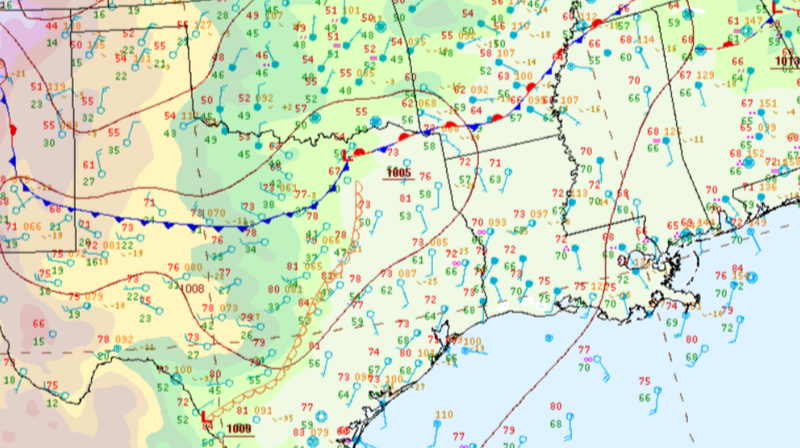
On Monday a cold/stationary boundary was oriented across the Southern Region where warm moist temperatures in Southern Louisiana resulted in thunderstorms and warm air in front of the cold front broke records in Central Texas.
Temperature:
Overall, December is when most of the region starts to see cooler temperatures most of the time as the “cool” season begins. Frequent cold fronts bring with them colder air masses from the north, bringing freezing temperatures to the northern portions of the region.
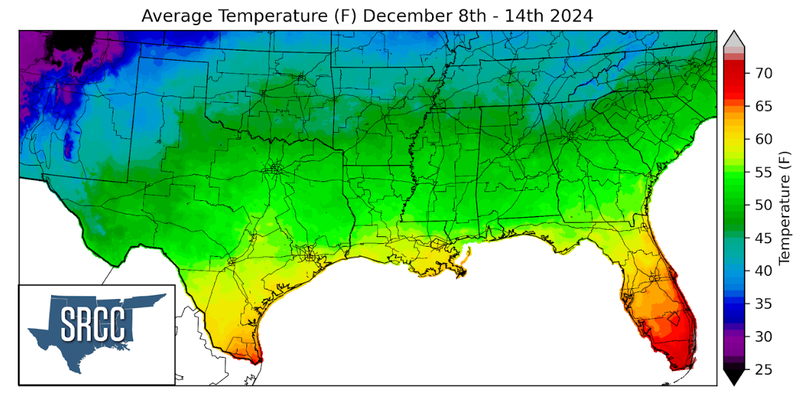
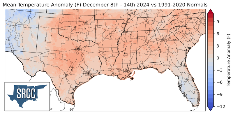
As mentioned above, temperatures were unseasonably warm to start last week. Thankfully, a strong cold front cooled things down over night on Monday. Following this front, temperatures were closer to normal until things started to heat back up by the end of the week. This resulted in weekly average temperatures slightly above normal in the Southern Region and values ranging from as much as 65 degrees in Deep South Texas to 35 degrees in the Oklahoma Panhandle.
Precipitation:
With the majority of the region being in a humid subtropical climate, rainfall is common at any point of the year. Frequently, during the winter months, cold fronts bring with them showers, thunderstorms, and even frozen precipitation to the Texas Panhandle, Oklahoma, Arkansas, and Tennessee. The boundary between the cold and warm air masses serves as a trigger mechanism for storms.
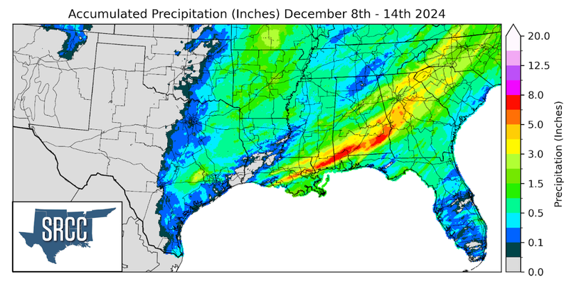
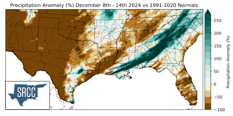
Early last week a thunderstorm initiated over Louisiana and Mississippi before organizing into a line of storms which moved southeast through Southern Louisiana and Mississippi. Rainfall totals from this storm system were significant, reaching as much as eight inches near the Mississippi coastline. Spotty showers occurred throughout the weekend resulting in moderate rainfall accumulations of about an inch in East Texas to Arkansas. The western half of the Region did not receive any precipitation last week, except for some small flurries Tuesday night in the Texas Panhandle.
