12/01/2024 - 12/07/2024
Climate in the News:
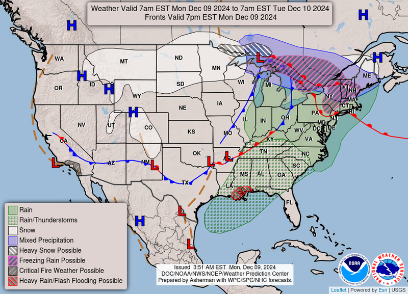
Ahead of a strong upper-level system, the eastern portion of the Southern Region is expected to see widespread thunderstorms. Additionally, heavy rain and potential flash flooding is possible along the eastern Louisiana coast. As this upper-level system moves through the Region so will a strong cold front, cooling things down.
Weather Synopsis:
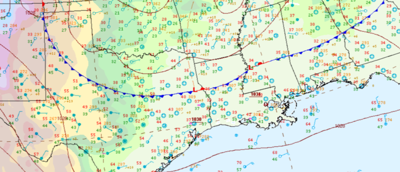
A strong cold front swept through the Region on Monday night which cooled off the Southern Region significantly. This front left temperatures cool for much of the week.
Temperature:
Overall, December is when most of the region starts to see cooler temperatures most of the time as the “cool” season begins. Frequent cold fronts bring with them colder air masses from the north, bringing freezing temperatures to the northern portions of the region.
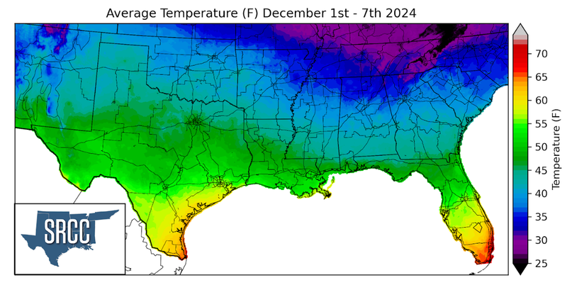
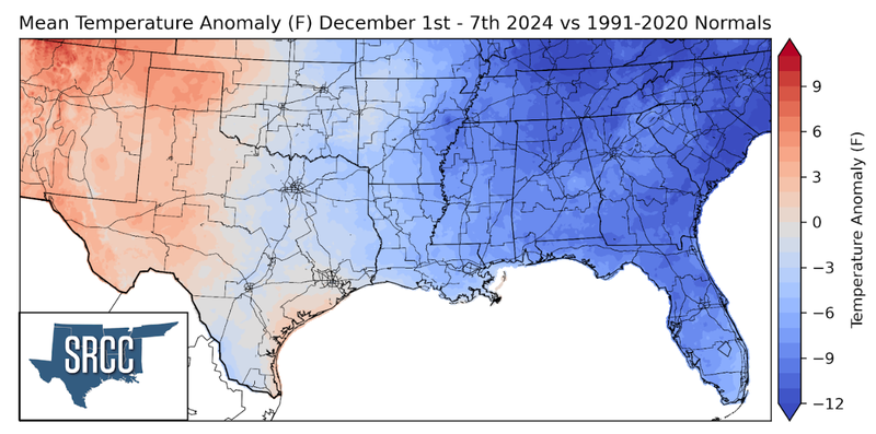
Following the cold front discussed above, temperatures in the Southern Region were quite chilly. Temperatures were at their coolest in Northern Tennessee where weekly average temperatures were as much as 12 degrees below zero. Temperatures started to warm up toward the end of the week in West Texas resulting in weekly average temperatures slightly above normal. Overall, weekly average temperatures ranged from about 55 to 35 degrees, about 5 degrees cooler than the week prior.
Precipitation:
With the majority of the region being in a humid subtropical climate, rainfall is common at any point of the year. Frequently, during the winter months, cold fronts bring with them showers, thunderstorms, and even frozen precipitation to the Texas Panhandle, Oklahoma, Arkansas, and Tennessee. The boundary between the cold and warm air masses serves as a trigger mechanism for storms.
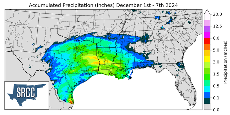
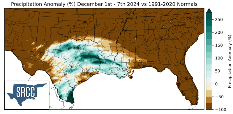
Precipitation in last week occurred toward the end of the week associated with a surface low-pressure system centered over Southeast Texas. Overall, precipitation totals were about one and a half inches from East Texas to Louisiana.
