10/06/2024 - 10/12/2024
Climate in the News:
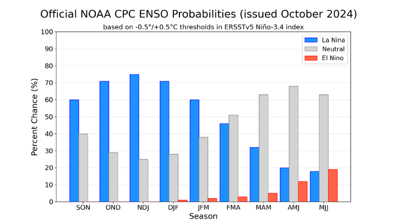
According to the NOAA Climate Prediction Center, La Niña is expected to emerge by November and remain until the early spring months of next year. This time, La Niña is favored to be a weak event, meaning that wintertime in the Southern Region may not be much drier or warmer than normal. Current Pacific Ocean weather patterns reflect ENSO-neutral conditions with near-average sea surface temperatures and near-average thunderstorm activity over the western Pacific.
Weather Synopsis:
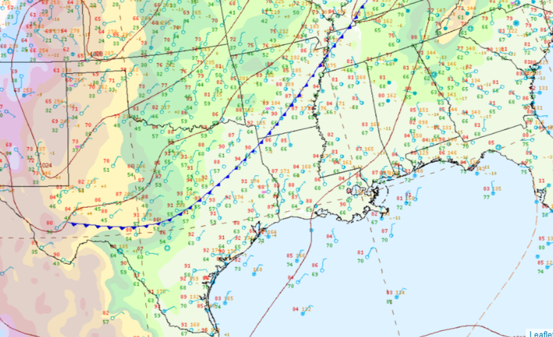
On Monday, a cold front from a low-pressure system moved across the Midwest and draped down across the Southern Region. It brought a cooler and drier airmass south, dropping temperatures by ten degrees on Tuesday and Wednesday. The cold front did not produce rainfall in the Southern Region, as mid-atmospheric conditions were unfavorable for developing thunderstorms.
Temperature
Overall, fall days in October are comfortable across most of the region. Weekly cold fronts are quite common, bringing with them colder air masses from the north.
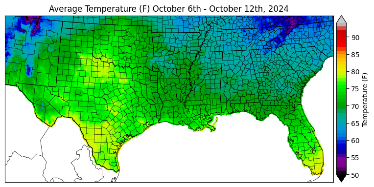
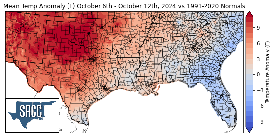
Last week’s cold front carried dry and cooler air to the Southern Region. The cooler air mass dropped temperatures in Tennessee and moderated temperatures close to the coast. As a result, Tennessee averaged temperatures in the 60s last week. On the other hand, drier air in Texas and Oklahoma allowed temperatures to rise more than 10 degrees above normal.
Precipitation
The climate for the majority of the region is humid and subtropical, with rainfall common at any point of the year. During the fall months, cold fronts are frequent and may bring showers and thunderstorms. The boundary between the cold and warm air masses serves as a trigger mechanism for storms.
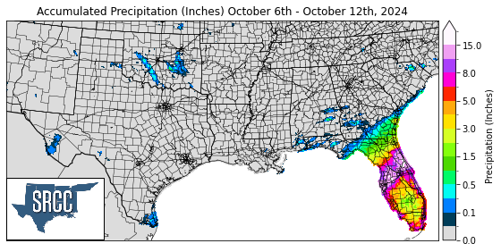
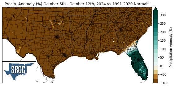
Despite last week’s cold front, precipitation was scarce and scattered. Only a few parts of Texas and Oklahoma were fortunate to receive up to half an inch of rainfall. The Region did not experience any severe thunderstorms. The only severe event reported was a 62 mph wind gust recorded from a dying storm in the Texas Panhandle on Wednesday. Outside of the Southern Region, Florida was devastated with the landfall of Hurricane Milton. The Tropical Cyclone made landfall as a Category 3 and brought over 15 inches of rainfall on October 10th to central Florida. The Tampa Bay area was most vulnerable to the storm, and experienced catastrophic flooding due to excessive rainfall and storm surge. The National Weather Service reported that 18.31 inches of rain fell in St. Petersburg within 24 hours, including 5.09 inches falling within one hour.
