09/15/2024 - 09/21/2024
Climate in the News:
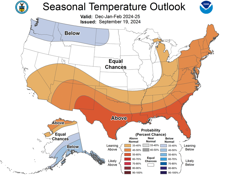
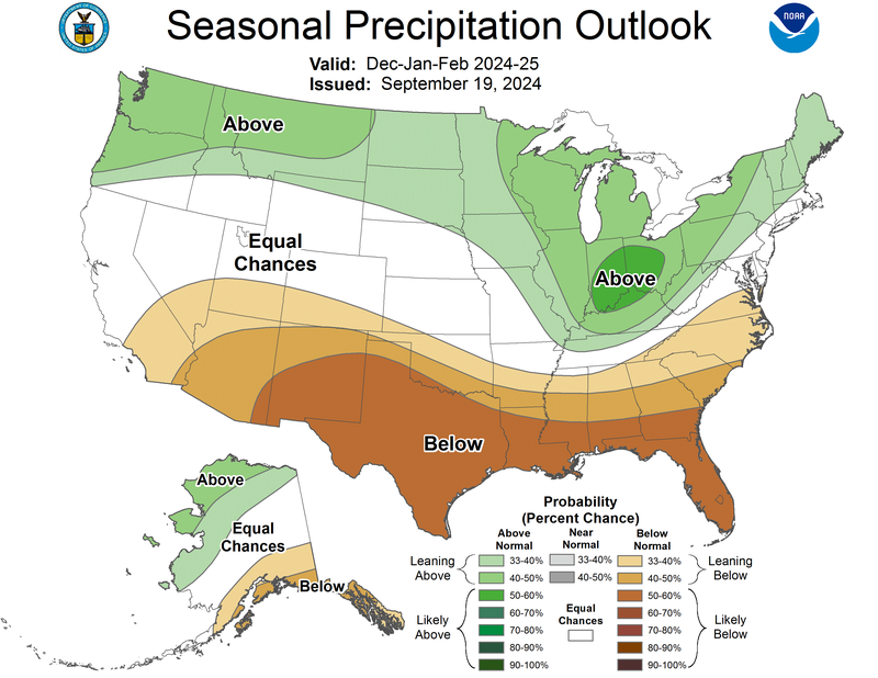
The Climate Prediction Center has released their seasonal temperature and precipitation outlook for this winter. This outlook follows very closely with their forecast for the El Nino Southern Oscillation, in which by this winter we are expected to be in La Nina conditions. Outlined by their seasonal outlook La Nina conditions in the Northern Hemisphere winter tend to bring warmer temperatures and drier conditions for the Southeast United States. For the Southern Region, the greatest chances for above normal temperatures are in the southern portions of Texas, Louisiana, and far southern Mississippi, with all but the northeastern portion of the region expecting below average rainfall.
Weather Synopsis:
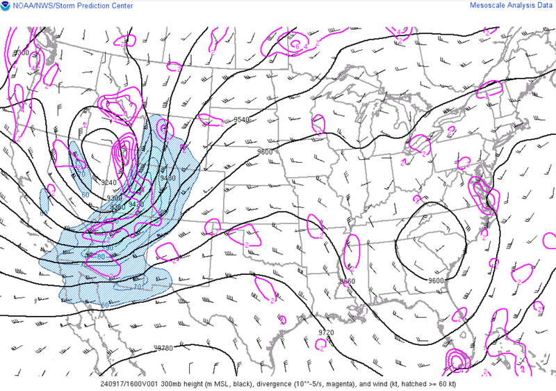
For much of the week, the Southern Region was stuck between two upper-level low-pressure systems, resulting in a high-pressure system sitting over the region. This brought us warm temperatures and sunny skies for much of the week.
Temperature:
Climatologically, fall days in September are still fairly warm across most of the region. Although, weekly cold fronts are quite common, bringing with them cooler, more fall-like temperatures.
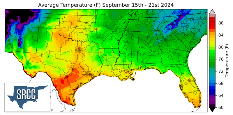
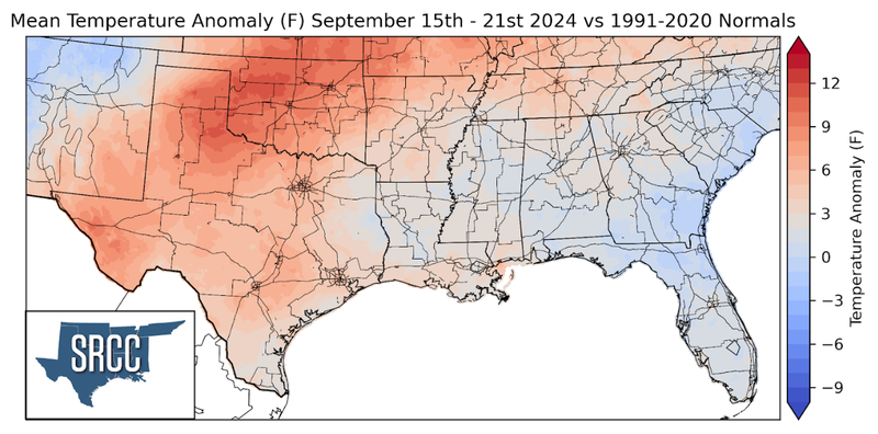
Temperatures were quite warm in the western half of the region last week as a result of the high-pressure system discussed above. Weekly average temperatures were as much as ten degrees above normal in western Oklahoma, but temperatures were near normal in Louisiana and Mississippi. Without a cold front advancing through the region, the dew point temperatures were quite high, leaving it feeling very muggy out. Weekly average temperatures were highest in the Rio Grande Valley of Texas, around 86 degrees, and coolest in the Smokey Mountains of eastern Tennessee at 68 degrees Fahrenheit.
Precipitation:
The climate for the majority of the region is humid and subtropical, rainfall is common at any point of the year. Frequently, during the fall months, cold fronts bring with them showers and thunderstorms. The boundary between the cold and warm air masses serves as a trigger mechanism for storms.
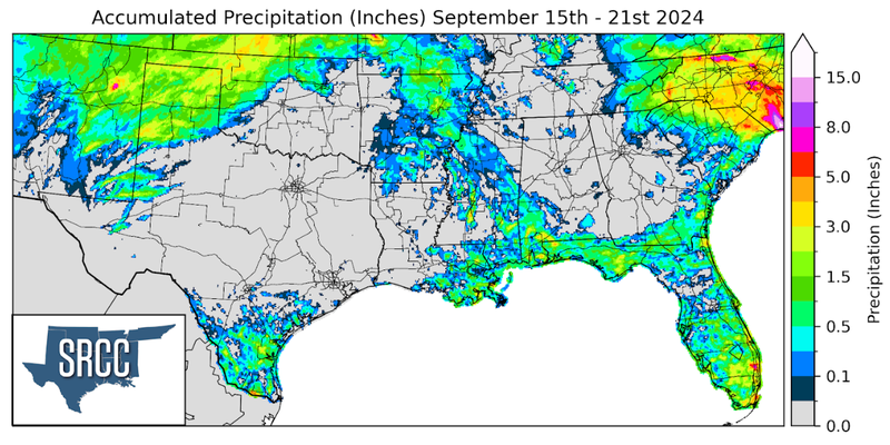
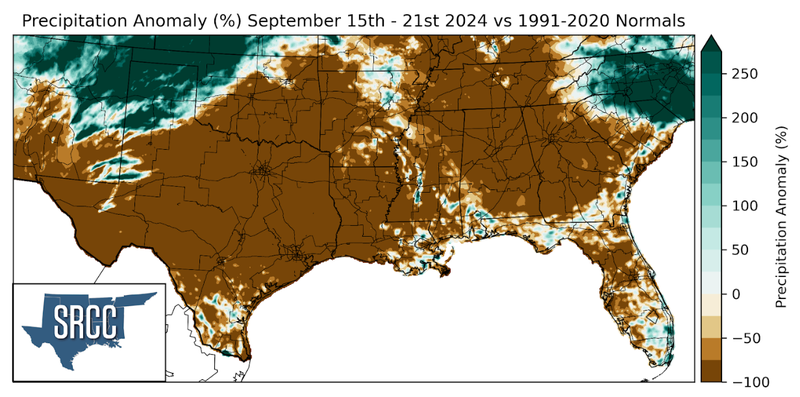
The remnants of Hurricane Francine could still be seen at the beginning of the week as Arkansas and Mississippi received a little more rain from the system before it dissipated. Aside from this much of the region was dry last week until the weekend. Friday and Saturday storms popped up along a weak dryline in New Mexico. As the day progressed these storms moved into the Texas Panhandle and western Oklahoma. These storms brought severe hail, winds, and even a brief tornado in Castro County, TX. Rainfall from this storm system also resulted in the Panhandle and western Oklahoma seeing an inch and a half up to four inches of rain in some areas.
