09/08/2024 - 09/14/2024
Climate in the News:
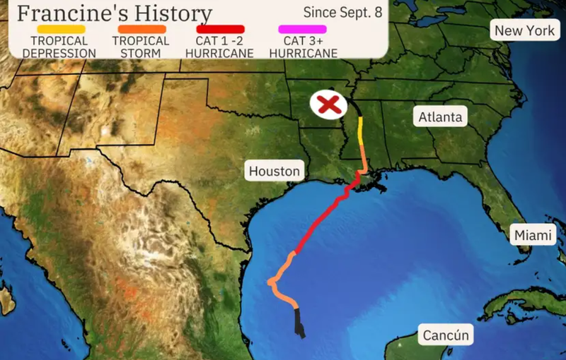
Last Wednesday, Francine made landfall in Terrebonne Parish, Louisiana at 5pm as a Category 2 Hurricane. The sustained winds were estimated to be near 100 miles per hour. The storm surge reached as high as four feet in southern Louisiana, leaving some coastal communities underwater. As Francine continued to move inland toward New Orleans, it brought heavy rains and flooding to the city. Rain totals reached eight inches in some parts of the city. According to PowerOutage.us, about 318,000 customers lost power across Louisiana, Mississippi, Alabama, and Tennessee.
Weather Synopsis:
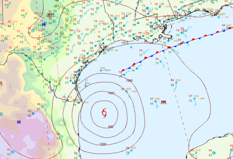
Hurricane Francine formed in the Gulf of Mexico just to the west of the northern Mexican coast. Once strengthening into a tropical storm, its outer rainbands brought two days of soaking rains to far South Texas.
Temperature:
Climatologically, fall days in September are still fairly warm across most of the region. Although, weekly cold fronts are quite common, bringing with them cooler, more fall-like temperatures.
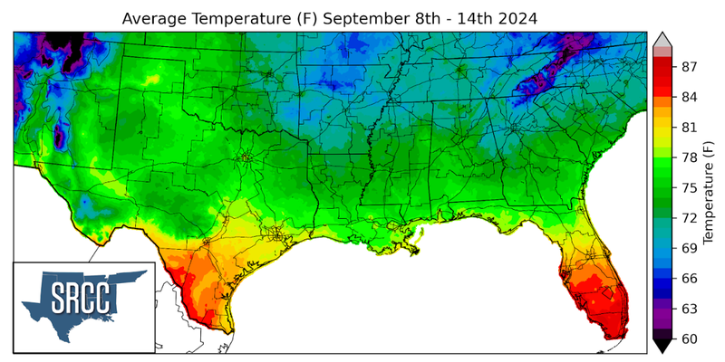
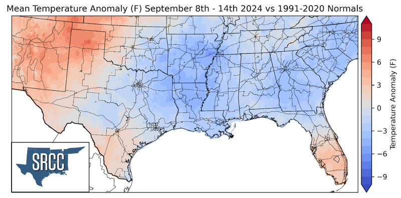
Temperatures across the region were quite mild again last week due to a late-week cold front and several days of cloud cover in the eastern portions thanks to Hurricane Francine. Therefore, the eastern portion of the region experienced temperatures below normal, while the far western portion saw temperatures just slightly above normal. The largest departure from normal was observed in eastern Arkansas where the average weekly temperature was about six degrees below normal. Weekly average temperatures were highest in the Lower Rio Grande Valley of Texas, around 84 degrees, and coolest in the Davis Mountains of West Texas at 67 degrees Fahrenheit.
Precipitation:
The climate for the majority of the region is humid and subtropical, rainfall is common at any point of the year. Frequently, during the fall months, cold fronts bring with them showers and thunderstorms. The boundary between the cold and warm air masses serves as a trigger mechanism for storms.
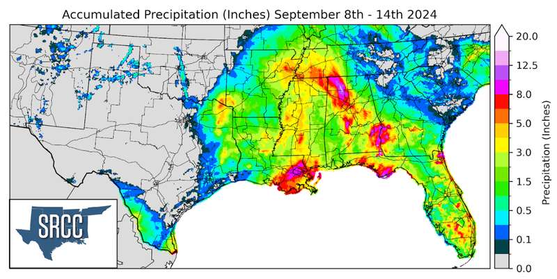
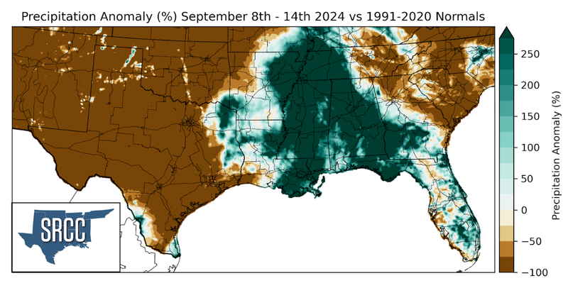
Hurricane Francine was the driving force behind precipitation in the Southern Region last week, as a result of this much of Texas and Oklahoma did not see any rain. Weekly rainfall totals in southeast Louisiana were eight inches, with the New Orleans metro receiving ten inches. As discussed above as a tropical storm, Francine brought significant rainfall to far South Texas. Along the Texas-Mexico border near Brownsville, TX weekly rainfall totals were as much as ten inches. Most of this rainfall was received on Tuesday. A CoCoRaHS observer near the Mexican border in Cameron County reported 7.15 inches of rain on Tuesday as well. Throughout Francine's path precipitation totals were well above normal, seeing at least four inches of rain last week. This resulted in urban flash flooding in several cities.
