09/01/2024 - 09/07/2024
Climate in the News:
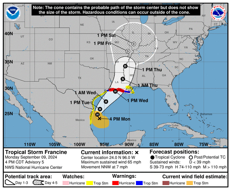
As we near the peak of the Atlantic Hurricane Season, Tropical Storm Francine is right on time. Forming just off the coast of Northern Mexico on September 9, Francine is forecasted to shift north-northeast over the Gulf waters. These warm Gulf waters will give the storm plenty of strength to strengthen to a Category 2 Hurricane, before it is expected to make landfall just after noon on Wednesday. Life-threatening storm surge is expected from the Upper Texas coast across the southern Louisiana coast. Damaging hurricane-force winds are a concern for portions of Louisiana by early Wednesday. Finally, this storm also brings with it the risk of flash flooding in urban areas across the mid-south from Wednesday to Friday. For the most recent information please visit https://www.nhc.noaa.gov/ .
Weather Synopsis:
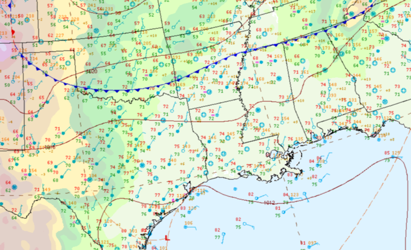
The cold front shown below would produce almost all of the weather the Southern Region saw last week. In this frame on Monday morning it had made it through the most northern portions of the region, but by the evening on Monday this front would stall from central Texas to central Mississippi. As it stalled it brought plentiful rain Monday and Tuesday before finally pushing to the Gulf Coast. By Tuesday evening, after making it offshore, this front would stall again, producing several days of rain for the Gulf Coast and Louisiana.
Temperature:
Overall, fall days in September are still fairly warm across most of the region. Although, weekly cold fronts are quite common, bringing with them cooler, more fall-like temperatures.
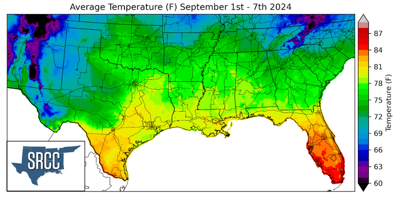
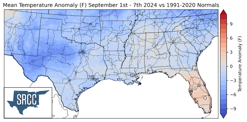
Temperatures were mild across the Southern Region last week as the result of an early and late week cold front sweeping through. This resulted in below-normal average weekly temperatures across the Region. Temperatures were even cooler though in West-Central Texas where it was seven degrees below normal. Weekly average temperatures were their hottest in the Lower Rio Grande Valley of Texas, around 83 degrees, and coolest in the Davis Mountains of West Texas at 63 degrees Fahrenheit.
Precipitation:
With the majority of the region being in a humid subtropical climate, rainfall is common at any point of the year. Frequently, during the fall months, cold fronts bring with them showers and thunderstorms. The boundary between the cold and warm air masses serves as a trigger mechanism for storms.
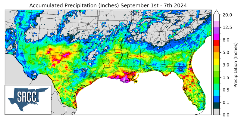
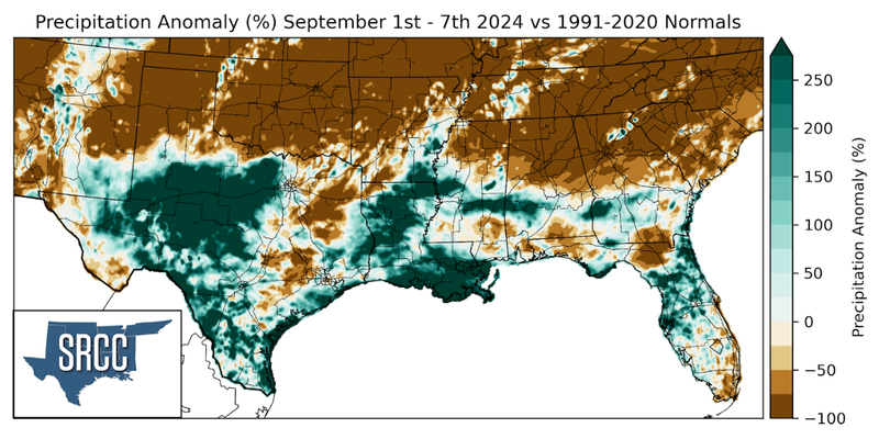
An abundance of rain fell in the southern half of the region with large areas of Texas and Louisiana seeing precipitation totals well above normal last week. Throughout the week a stationary boundary sat near coastal Louisiana bringing daily totals of one to two inches by the end of the week. All this rain led to a weekly accumulation of ten inches along most of the Louisiana coast. Isolated areas within this saw as much as 15 inches! West-Central Texas was able to get some much-needed rain last week as showers from Monday night organized by Tuesday morning and turned into a slow moving line of thunderstorms. This line of thunderstorms brought copious rains to the area, with most locations receiving four inches last week. Some isolated areas, such as Callahan County, TX received ten inches, with 8.14 inches of rain falling from Monday morning to Tuesday morning according to a CoCoRaHS report.
