03/09/2025 - 03/15/2025
Climate in the News:
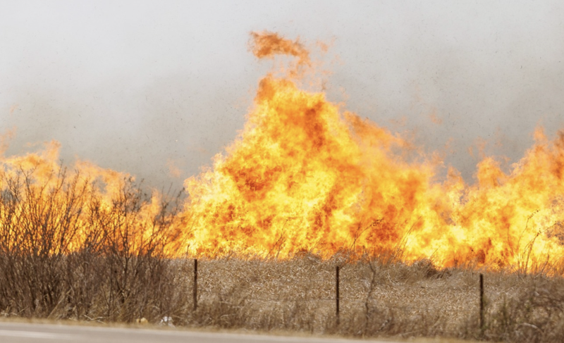
Dangerous fire weather conditions were observed last week in Texas, Oklahoma, and Arkansas. Several fires ignited this past weekend in Texas and Oklahoma. According to the Oklahoma Department of Emergency Management, more than 130 fires were reported in 44 different counties on Friday. One of these fires was in Stillwater Oklahoma, where 75 structures were lost to the flames. In Texas and Oklahoma several wildfires are still ongoing. Fire weather conditions remain around today and are anticipated to persist until the end of the week accompanied by a dry precipitation forecast ahead.
Weather Synopsis:
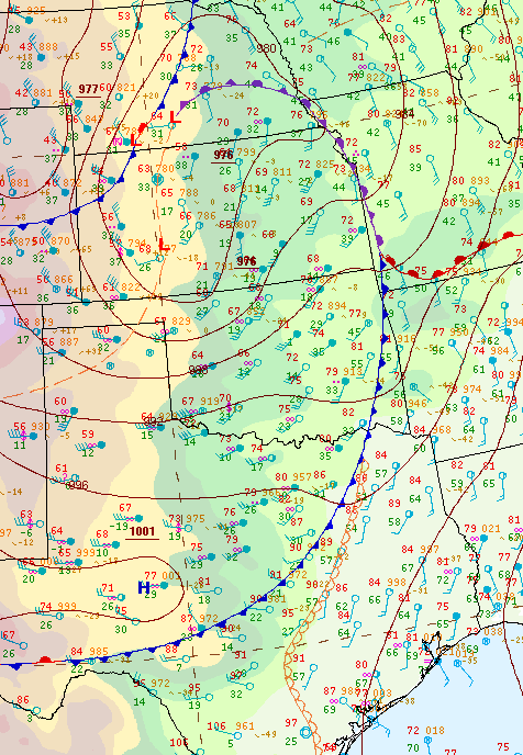
The surface analysis below can explain fire weather conditions this past Friday. An abnormally low surface low-pressure system in Kansas set up the perfect storm for some very fast and gust surface winds in North Texas and Oklahoma. Additionally, Oklahoma and the Texas Panhandle sitting west of the dryline (a moisture boundary) left things very dry. This was the perfect storm for some fast-spreading fires.
Temperature:
Overall, March is when the Region is starting to warm up. However, frequent cold fronts are still common, bringing rain chances and below-normal temperatures for a few days.
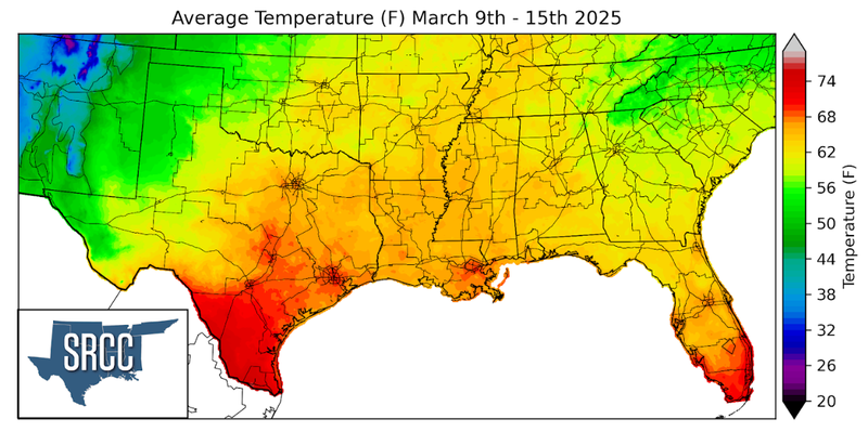
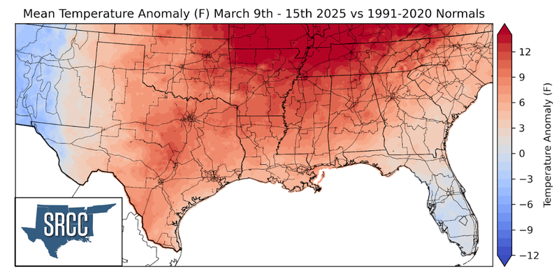
Temperatures felt very spring-like across the Southern Region last week. Across the region, weekly average temperatures were above normal, with the largest departure from normal in Northern Arkansas/Western Tennessee where temperatures were more than 12 degrees above normal. Overall weekly average temperatures hovered around 60 to 68 degrees Fahrenheit for much of the Region.
Precipitation:
With the majority of the Region being in a humid subtropical climate, rainfall is common at any point of the year. Frequently, during the spring months, storm systems are also common throughout the south. During March severe storm probabilities are at their highest in the Lower Mississippi Valley.
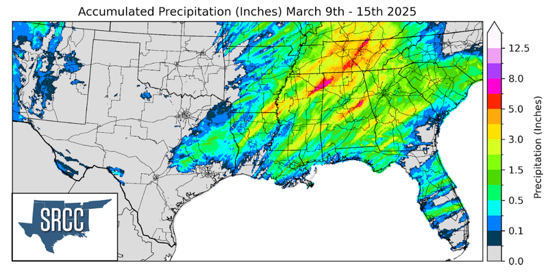
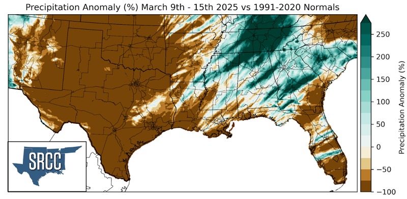
Last week precipitation was confined to the eastern half of the Region. Over the weekend, strong, severe thunderstorms formed in Western Arkansas and Western Louisiana before moving eastward. This slow-moving severe weather system resulted in several flash flood warnings from Northern Louisiana to Tennessee. Tennessee saw the most rain from this storm system with most of the state seeing at least three inches and some areas seeing as much as six inches. Several strong and damaging tornadoes also occurred with this storm system. For a more detailed analysis of this please check back in the beginning of April for our March Monthly Summary.