03/02/2025 - 03/08/2025
Climate in the News:
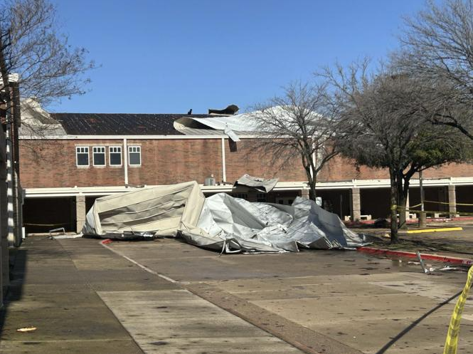
Early morning severe storms tore through the Dallas-Fort Worth Metroplex last Tuesday resulting in significant straight-line wind and isolated tornado damage. In Denton County, winds of over 80 mph were reported, and in Dallas County 78 mph winds were reported at Dallas-Love Field Airport. These strong winds caused significant structural damage, taking off part of the roof at Plano West Senior High School, photographed below. Additionally, an EF-1 tornado confirmed in Irving, Texas damaged several structures. Thankfully, there were no reported fatalities or injuries. Meteorological spring has only just begun as the Mississippi Valley gears up for a severe weather system Friday and Saturday.
Weather Synopsis:
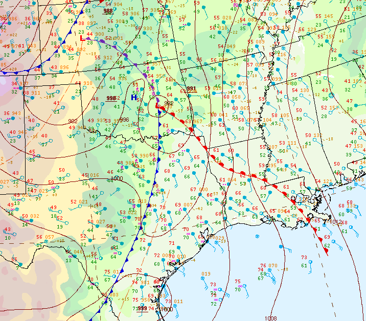
Below is a surface analysis displaying the setup for Tuesday morning’s severe storms. A strong parent low-pressure system can be seen in West Kansas. This setup brought through a cold front which helped fire off these early morning thunderstorms.
Temperature:
Overall, March is when the Region is starting to warm up. However, frequent cold fronts are still common, bringing rain chances and below-normal temperatures for a few days.
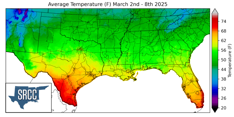
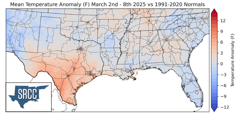
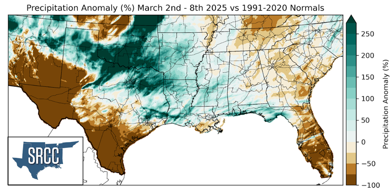
When compared to climatological normals, temperatures across the Southern Region were very close to normal across the Region. The most consistent spatial departure was found in South Texas where weekly average temperatures were a few degrees above normal. Overall, these weekly average temperatures feel around 55 to 60 degrees Fahrenheit for much of the Region.
Precipitation:
With the majority of the Region being in a humid subtropical climate, rainfall is common at any point of the year. Frequently, during the spring months, storm systems are also common throughout the south. During March severe storm probabilities are at their highest in the Lower Mississippi Valley.
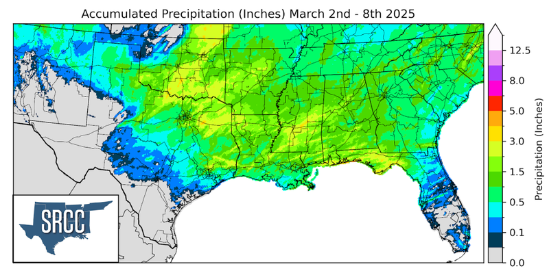
Precipitation was moderate yet widespread from East Texas/Central Oklahoma east throughout the Region. Rainfall totals were about an inch in most places with higher totals seen inside thunderstorms, up to 4 inches.