02/16/2025 - 02/22/2025
Climate in the News:
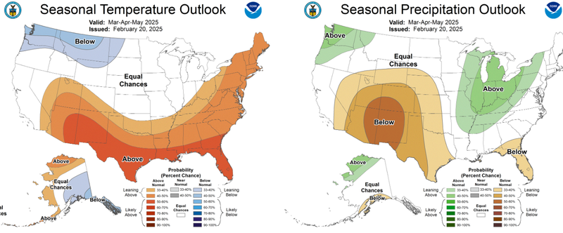
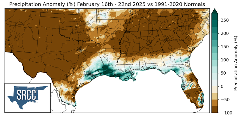
Last week NOAA’s Climate Prediction Center released their seasonal temperature and precipitation outlook for Spring 2025. Notably, we see that the entirety of the Southern United States is likely to see above normal temperatures, with chances increasing toward the southern border. Looking at the precipitation outlook, most of Oklahoma and Texas can expect to see precipitation totals below normal, whereas Tennessee and Northeast Arkansas can expect to see precipitation totals slightly greater than normal. The rest of the Southern Region will likely see precipitation totals near normal.
Weather Synopsis:
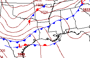
As seen on the frontal analysis below, a cold front swept through the Southern Region last Tuesday. This cold front brought down Artic air from the pole, significantly lowering the temperatures in its wake.
Temperature:
Overall, February is when the Region consistently sees cooler temperatures. Frequent cold fronts bring with them colder air masses from the northern United States and Canada, bringing freezing temperatures to the northern portions of the Region.
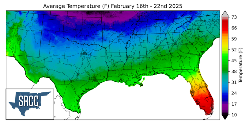
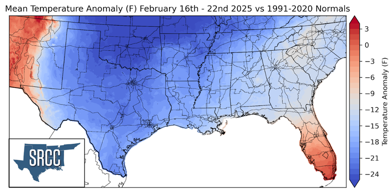
The aforementioned cold front resulted in a chilly week across the Southern Region. As a result, weekly temperature anomalies were well below normal, even as low as 25 degrees below normal in much of Oklahoma. Overall weekly average temperatures were cold throughout the Region, with temperatures around 45 degrees Fahrenheit South near the coast and temperatures near 20 degrees Fahrenheit in the more northern portions of the Region
Precipitation:
With the majority of the Region being in a humid subtropical climate, rainfall is common at any point of the year. During the winter months, cold fronts bring with them showers, thunderstorms, and frozen precipitation to the Texas Panhandle, Oklahoma, Arkansas, and Tennessee. The boundary between the cold and warm air masses serves as a trigger mechanism for storms.
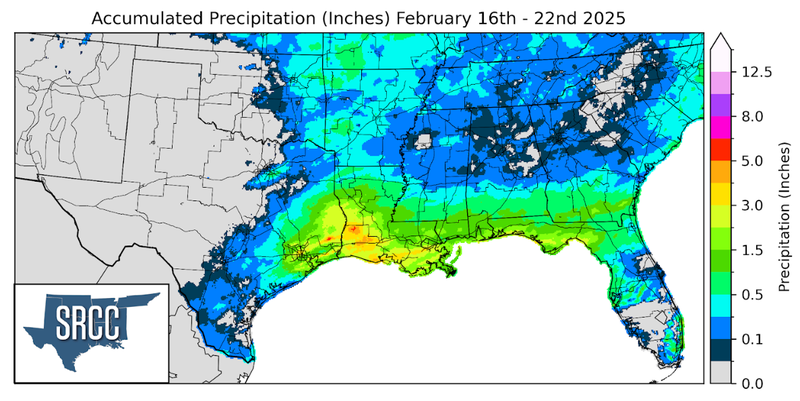
Marginal precipitation totals were confined to the Eastern portions of the Southern Region last week. The main driver for significant rainfall last week was the passage of the cold front which brought showers and thunderstorms to Southeast Texas and much of Louisiana. Behind the frontal system snow fell from North Texas east to Tennessee. Snowfall accumulations were the highest in Northwest Arkansas where five to six inches fell in most places.