02/09/2025 - 02/15/2025
Climate in the News:
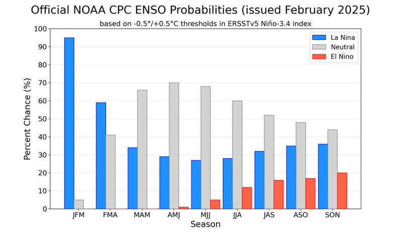
La Niña conditions continue to be present in the Equatorial Pacific, albeit weak, limiting regional impacts. The Climate Prediction Center (CPC) predicts this La Niña to be short lived, they have a 66% of a switch to ENSO Neutral conditions in the March to May time period. In the next three months, CPC predicts higher probabilities for above-normal temperatures and mixed precipitation chances for the Southern Region.
Weather Synopsis:
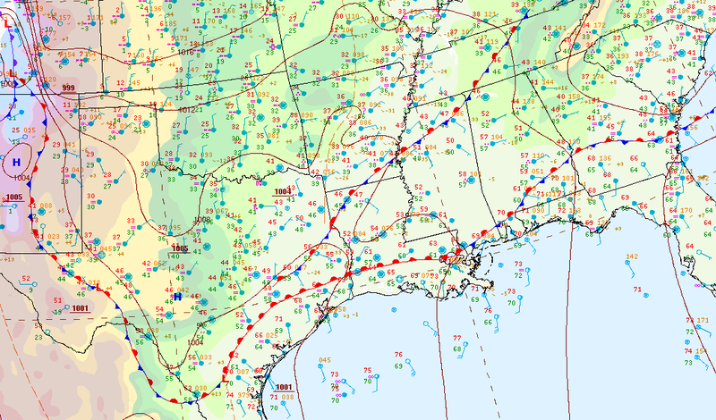
Widespread precipitation fell throughout the Region on Tuesday and Wednesday as stalled fronts and an advancing warm front created a disturbed weather pattern. Weather conditions quickly calmed down after an upper-level system pushed through a cold front leaving behind cold and dry air in its wake.
Temperature:
Overall, February is when the Region consistently sees cooler temperatures. Frequent cold fronts bring with them colder air masses from the northern United States and Canada, bringing freezing temperatures to the northern portions of the Region.
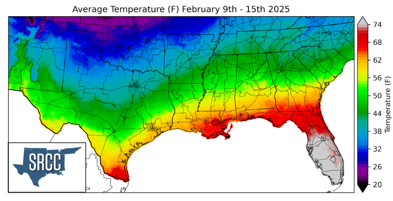
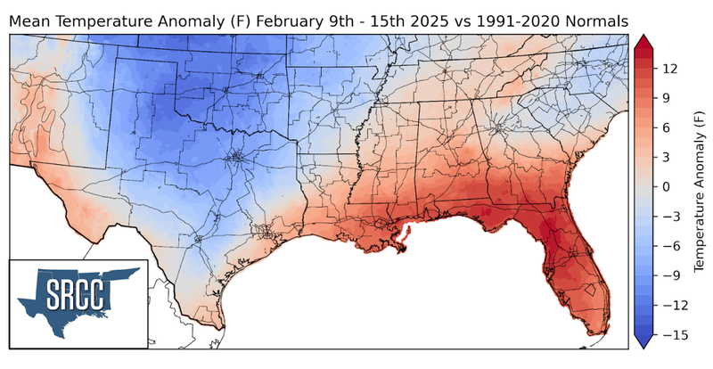
Last week started and ended in a post frontal environment with dry air and cool temperatures. Throughout the week though, temperatures warmed slightly but were limited by frequent cloud cover. Due to spending much of the week south of warm fronts and stall boundaries, areas near the Gulf saw weekly temperature anomalies slightly above normal. Farther inland though, in Central Texas and Oklahoma weekly temperatures were about 12 degrees below normal. Overall, temperatures varied widely across the Region last week, from about 65 degrees in Far South Texas to 26 degrees along the Oklahoma-Kansas border.
Precipitation:
With the majority of the Region being in a humid subtropical climate, rainfall is common at any point of the year. During the winter months, cold fronts bring with them showers, thunderstorms, and frozen precipitation to the Texas Panhandle, Oklahoma, Arkansas, and Tennessee. The boundary between the cold and warm air masses serves as a trigger mechanism for storms.
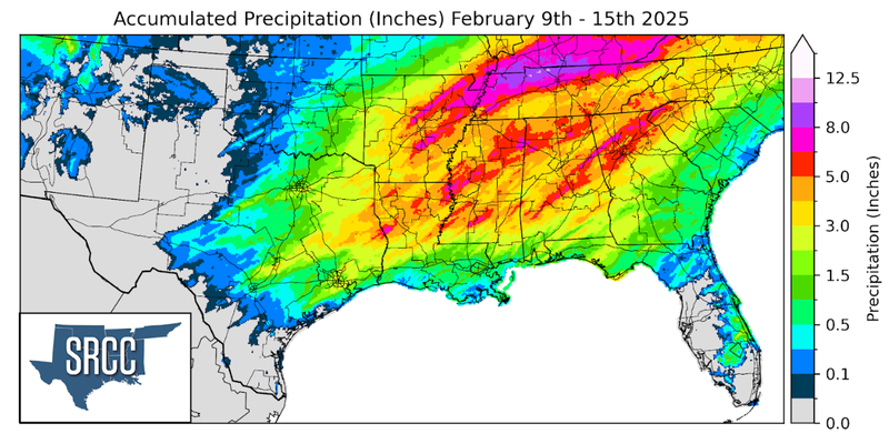
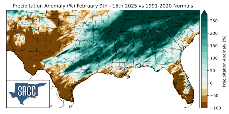
As already mentioned above, precipitation was widespread across the Southern Region last week. Two-inch rainfall totals were seen from East Texas into Georgia. The largest weekly precipitation totals were observed in Northeast Arkansas and Northern Tennessee where 7 to 8 inches of rain fell. These significant rainfall totals in Tennessee should help to improve drought conditions in the state.