02/02/2025 - 02/08/2025
Climate in the News:
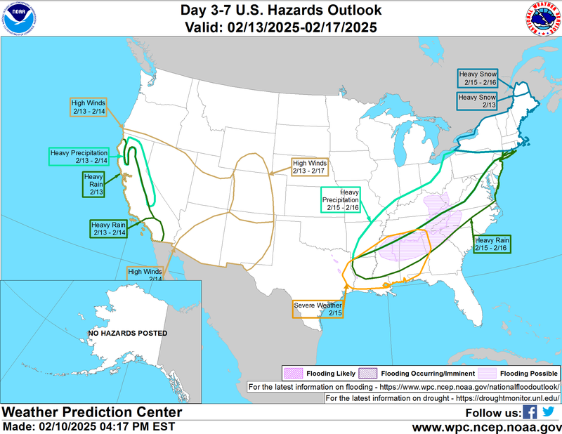
The Southern Region is gearing up for a busy weather pattern this weekend. Outlined by the 3-7 Day U.S Hazards Outlook from the Weather Prediction Office, Louisiana and Mississippi are under a slight risk for severe weather on Saturday. Additionally, this weather system will bring heavy precipitation to areas of Arkansas, Louisiana, Mississippi, and Tennessee. Associated with this heavy rainfall, Northern Mississippi is at risk of flash flooding and flooding of rivers and creeks.
Weather Synopsis:
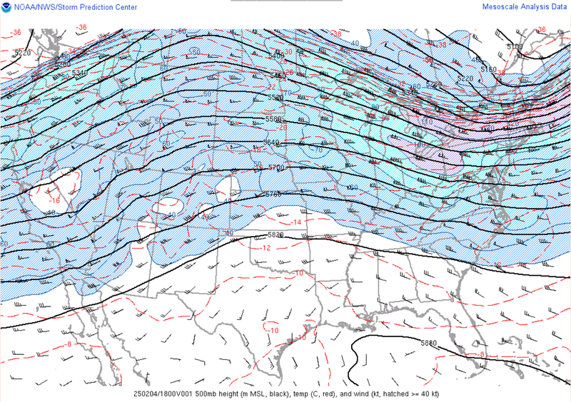
The weather map (below) displays the upper atmosphere (500 mb height). Over the Central and Southern plains riding (upside-down U-shape) can be seen. This upper-level ridging is associated with warm and fair weather at the surface, which dominated the weather pattern for much of last week.
Temperature:
Overall, February is when the Region consistently sees cooler temperatures. Frequent cold fronts bring with them colder air masses from the northern United States and Canada, bringing freezing temperatures to the northern portions of the Region.
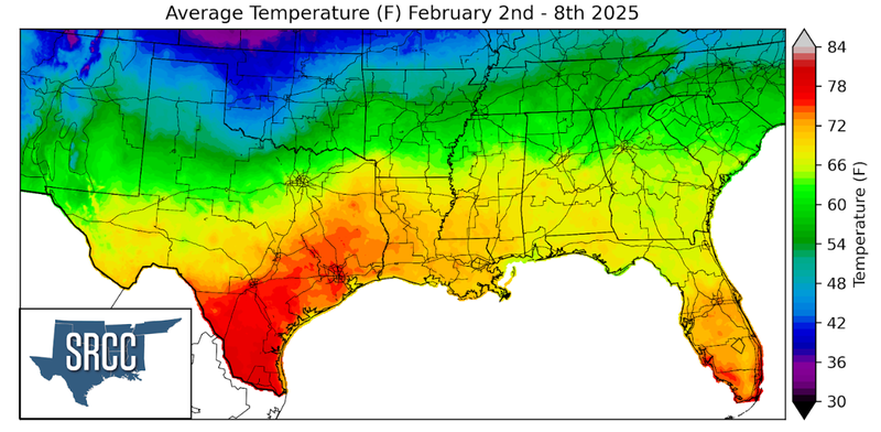
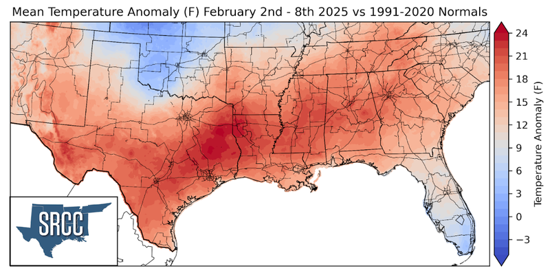
Despite being the first week of February, it felt like the middle of May in much of the Southern Region. Temperature records were shattered across the Region and weekly average temperatures were 15 – 20 degrees above normal across much of the Region. Weekly average temperatures even made it to 25 degrees above normal in East Texas! Overall, most temperatures across the Southern Region were between 60 to 70 degrees Fahrenheit, about 15 degrees warmer than last week.
Precipitation:
With the majority of the region being in a humid subtropical climate, rainfall is common at any point of the year. During the winter months, cold fronts bring with them showers, thunderstorms, and frozen precipitation to the Texas Panhandle, Oklahoma, Arkansas, and Tennessee. The boundary between the cold and warm air masses serves as a trigger mechanism for storms.
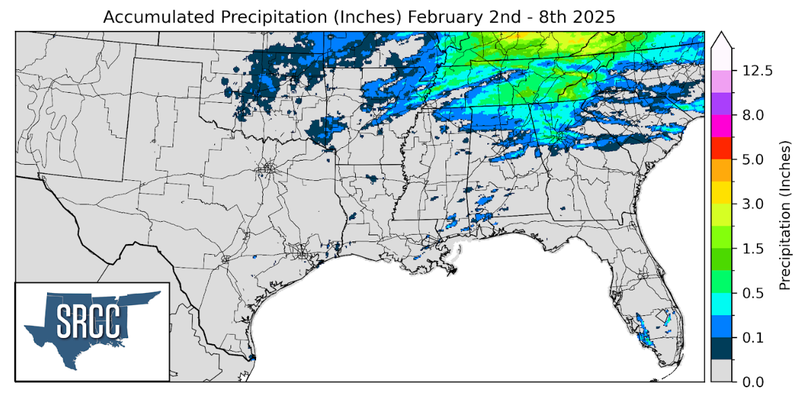
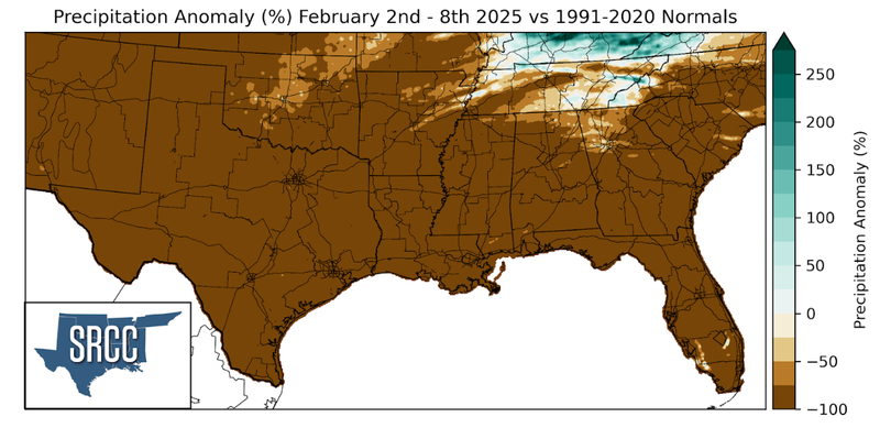
As a result of the upper-level ridging previously discussed, atmospheric conditions for any significant rainfall were not present last week across the Southern Region. Although, some precipitation fell in Tennessee over the weekend as a cold front stalled just south of the southern border of Tennessee.