01/26/2025 - 02/01/2025
Climate in the News:
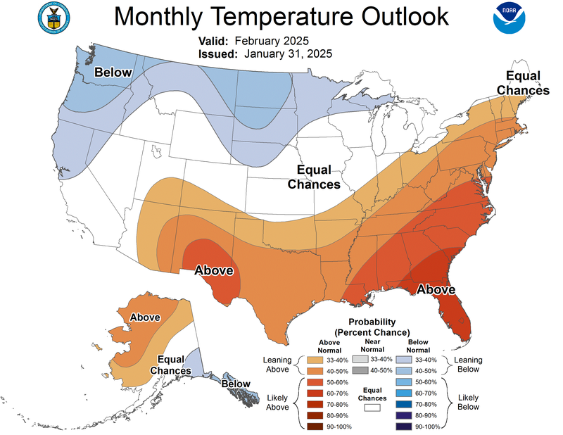
Yesterday was Groundhog Day and Punxsutawney Phil saw his shadow, traditionally meaning 6 more weeks of winter. But, the NOAA Climate Prediction Center also has a long-term outlook for the temperature. Displayed by the Monthly Temperature Outlook for February, above-normal temperatures are favored for the South. This aligns quite well with what we would expect for a La Niña winter.
Weather Synopsis:
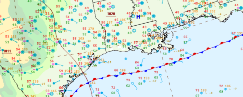
Mid-week, a front stalled along the coast introducing clouds and poor conditions across much of the Gulf States from Tuesday to Thursday. By Thursday a cold front pushed through the region leaving behind sunny skies.
Temperature:
January is when the Region consistently sees cooler temperatures. Frequent cold fronts bring with them colder air masses from the Northern United States and Canada, bringing freezing temperatures to the northern portions of the Region.
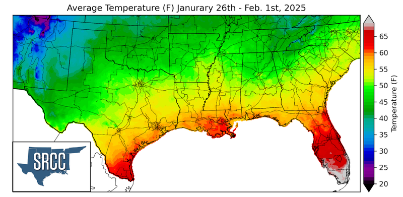
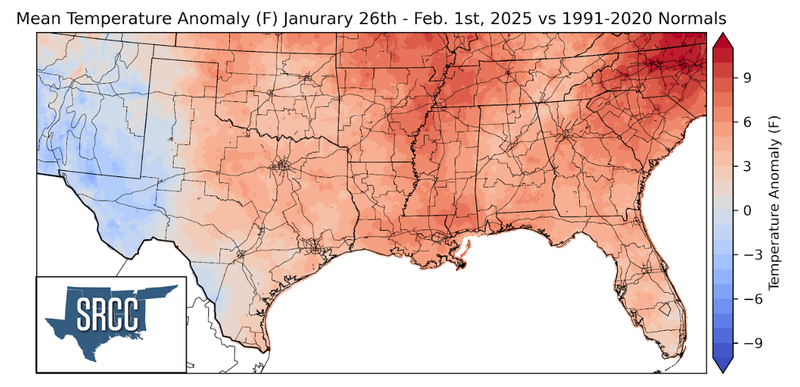
The week started with a cold front passing through on Sunday, this cold front stalled along the coast and warm air from the Gulf of Mexico returned. Temperatures continued to rise as this stalled front began to advance North as a warm front, before a strong cold front followed, ending the week with drier and cooler air. This resulted in temperatures slightly above normal for much of the Region. Overall, most temperatures across the Southern Region were between 45 to 55 degrees Fahrenheit.
Precipitation:
With the majority of the region being in a humid subtropical climate, rainfall is common at any point of the year. During the winter months, cold fronts bring with them showers, thunderstorms, and frozen precipitation to the Texas Panhandle, Oklahoma, Arkansas, and Tennessee. The boundary between the cold and warm air masses serves as a trigger mechanism for storms.
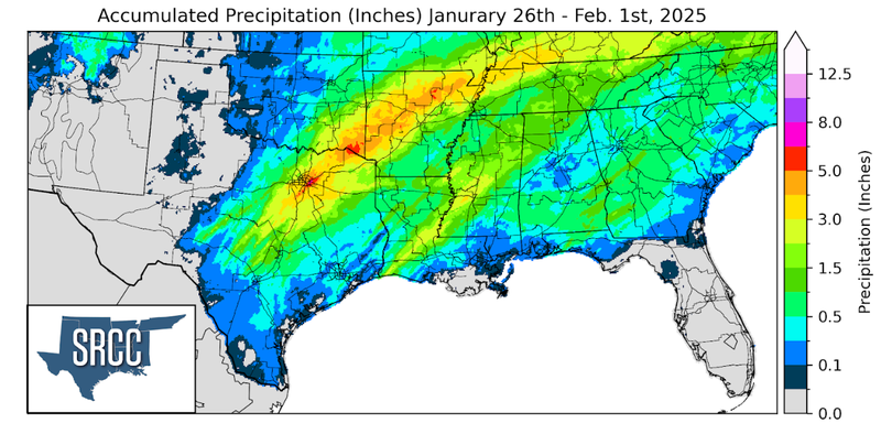
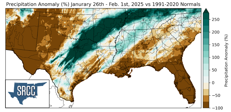
Widespread precipitation fell throughout much of the Region last week. Additionally, precipitation was especially abundant from Central Texas northeast to Arkansas where 3 to 5 inches of rain fell.