01/19/2025 - 01/25/2025
1/27/2025
Climate in the News:
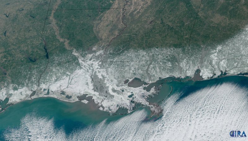
A historic snowstorm came through the Southeast United States last week. Snow fell from the Upper Gulf Coast of Texas to North Carolina and even as far south as Florida. In Southern Louisiana snowfall totals were near 8 to 10 inches even reaching one foot in some places. These snowfall totals squashed many existing records and even drove seasonal snowfall totals in Louisiana to greater than several cities in Alaska, Canada, and the Northeast. Additionally, with this event the National Weather Service office in Lake Charles issued their first ever Blizard Warning for Layfette, LA. Needless to say, this snowstorm will be remembered for generations to come.
Weather Synopsis:
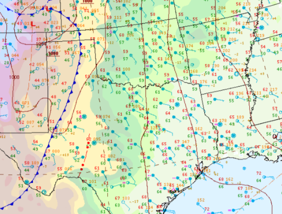
To understand this historic snowfall event, we must look back overnight on the 19th. Following the passage of a cold front, temperatures in Southeast Texas to costal Mississippi quickly dropped. This resulted in the perfect sub-freezing conditions for when another cold front and leading precipitation would arrive. Because temperatures in front of the cold front were already near to sub-freezing from the cold front on the 19th, precipitation seen was sleet, freezing rain, and snowfall.
Temperature:
January is when the Region consistently sees cooler temperatures. Frequent cold fronts bring with them colder air masses from the Northern United States and Canada, bringing freezing temperatures to the northern portions of the Region.
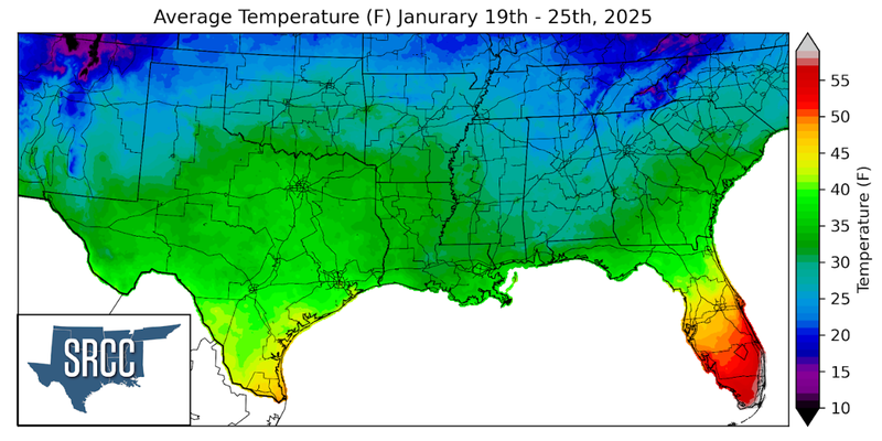
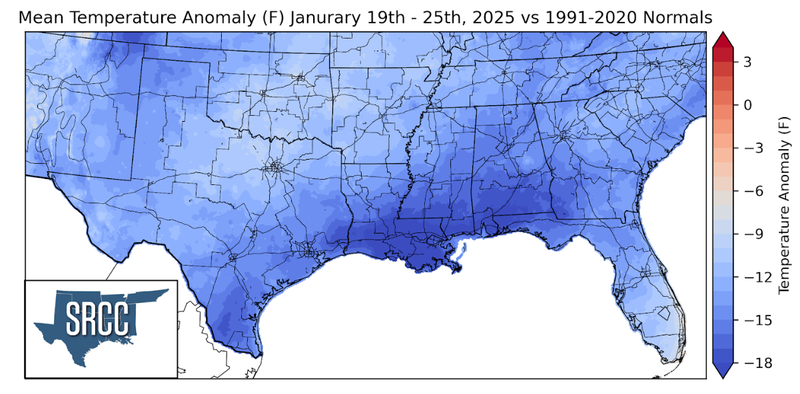
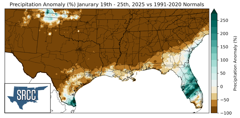
Two strong cold fronts and a blanket of snow left temperatures quite chilly in the Region last week. Across the Region, temperatures were at least twelve degrees Fahrenheit below normal. Temperatures were as much as 18 degrees below-normal in Southern Louisiana, where snow remained on the ground for three to four days, cooling down daily average temperatures. On average, weekly average temperatures were 35 to 27 degrees Fahrenheit, much colder than the week prior.
Precipitation:
With the majority of the region being in a humid subtropical climate, rainfall is common at any point of the year. During the winter months, cold fronts bring with them showers, thunderstorms, and frozen precipitation to the Texas Panhandle, Oklahoma, Arkansas, and Tennessee. The boundary between the cold and warm air masses serves as a trigger mechanism for storms.
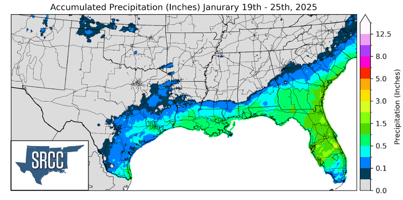
Precipitation fell in the form of sleet, freezing rain, and primarily snow. This winter precipitation was concentrated along the Gulf Coast with the heaviest snow falling in Southeast Louisiana. Additionally, snow from this system also fell in the Texas and Oklahoma Panhandles. While snowfall totals from this system were very large the water equivalent ranged from half an inch to an inch and a half.