6/27/2024
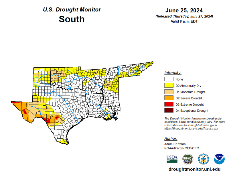
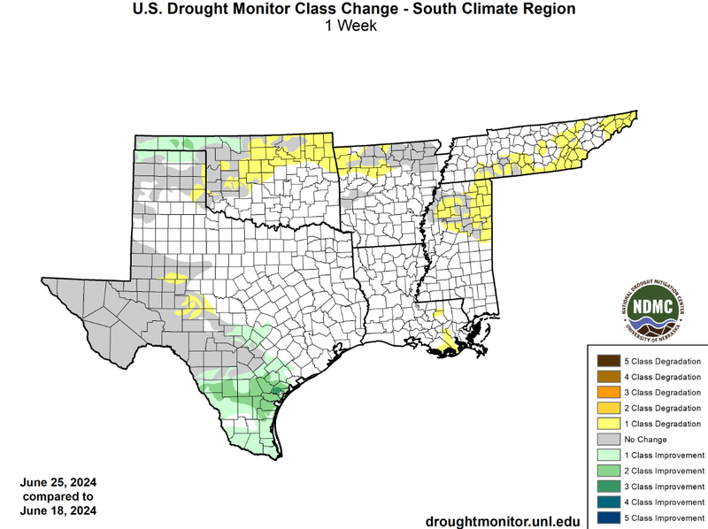
Last week Tropical Storm Alberto greatly impacted drought conditions in South Texas. The storm dropped five inches of rain in South Texas, with some areas reaching up to eight inches. This plentiful rain resulted in flash flooding and helped the soil regain moisture. As a result, widespread one-class and two-class improvements were observed, as well as isolated three-class improvements. These vast improvements help to ameliorate drought in Deep South Texas, with the expectation of a few counties near the Mexican border still experiencing abnormally dry conditions. Improvements were also observed in the Oklahoma Panhandle where dryline-initiated thunderstorms helped provide much-needed rain. Unfortunately, one-class degradations were observed in northern Oklahoma, northwest Arkansas, Tennessee, northern Mississippi, and southeast Louisiana. These degradations which were fueled by above-normal temperatures led to the introduction of abnormally dry and drought conditions in those areas.
Looking into the future, outlined by the 6-10 Day Outlook from the Climate Prediction Center, the eastern half of the Region can expect above-normal temperatures and below-normal precipitation chances. This will likely result in the expansion of drought conditions in Tennessee and northern Mississippi.