5/16/2024
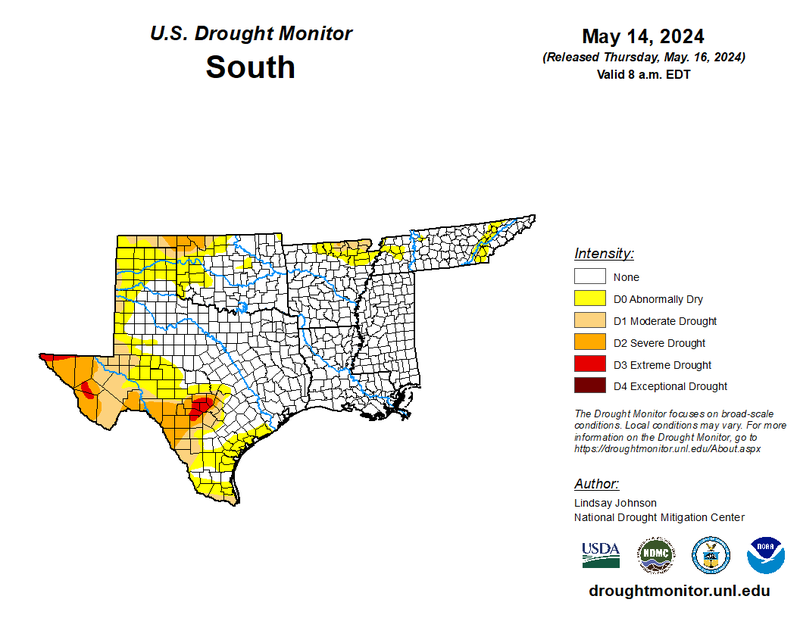
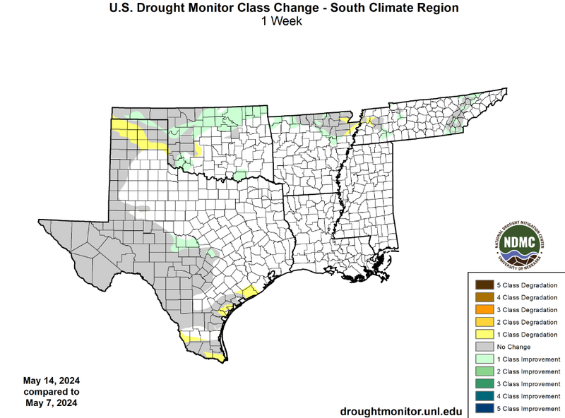
Much of the Southern Region experienced high amounts of moisture in the air as well as other necessary conditions for multiple days of storms. Early in the week, Oklahoma saw a substantial amount of rainfall as storms fired along the dryline in western Oklahoma. These storms eventually organized into a slow-moving line of thunderstorms leading to flash flooding. Due to this, areas lacking significant rainfall in northern Oklahoma were able to see one-class improvements. These improvements led to the contraction of drought (D1-D4) in Oklahoma by about 8% from the week prior. Isolated one-class improvements were also observed in the Texas Hill Country, northern Arkansas, and the Great Smoky Mountains of Tennessee. Some one-class degradation was also observed in the Texas Panhandle as most storms initiated to the east of the region and South Texas where record-breaking heat was felt last week.
Looking into the future, as outlined by the 8-14 Day Hazards Outlook, South Texas is expected to see more excessive heat from the 23rd through the 25th. This excessive heat combined with low forecasted rainfall totals from a tenth to a quarter of an inch is likely to contribute to the expansion of drought in South Texas.