04/25/2024


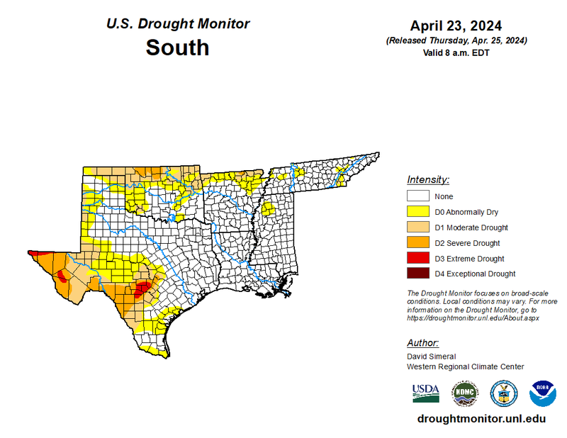
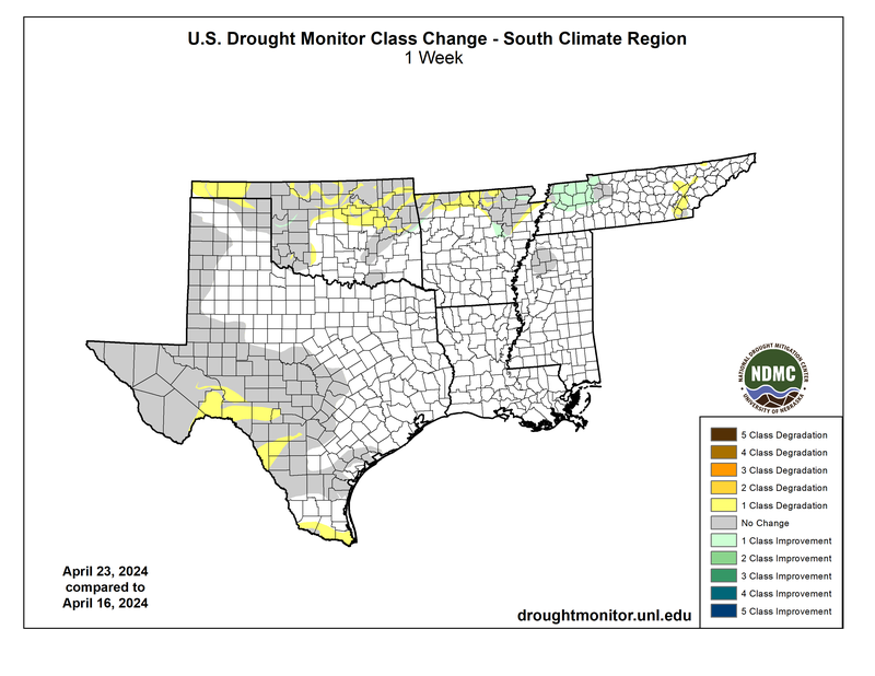
Last week, warmer-than-normal temperatures and wet conditions dominated most of the Southern Region - most of this credited to a stationary front draped throughout the Southern Region’s coastal plains. Warm and moist air from the Gulf of Mexico rose over the cooler air that traveled from the north from Friday, April 19, to Sunday, April 21. As it rose, clouds formed and left most of the states in our region cloudy and wet. Dallas, TX, received its fourth-largest single-day rainfall total ever recorded in April on Saturday, with 4.22 inches of rain! Most of Texas and portions of Arkansas, Mississippi, and Louisiana received well above normal rainfall. Most notably, west Texas’ recorded precipitation was 300% higher than normal climatological for the last week in April. While most areas there only received 1-2 inches of rain from this event, this is significant for the communities that typically receive little to no rainfall this time of year. However, the rainfall was not significant enough and long-lasting enough to ameliorate the area’s (D0) abnormally dry and (D1) Moderate Drought effects. One-Classification degradations spread throughout north Oklahoma, Arkansas, and south Texas along the Rio Grande River. These areas did not receive rainfall over the past week. Most of the southern Texas border and east Tennessee experienced higher-than-normal temperatures, up to 9 degrees Fahrenheit warmer than the normal for this week. This period of dryness lasted for up to three months in central and southern Texas, and water levels in streams and reservoirs lowered in Texas, Oklahoma, and Arkansas.
Looking toward the future, severe thunderstorms are also probable in the Southern Plains and the ArkLaTex region tonight through Monday. As forecasted by the Storm Prediction Center, all severe hazards are possible with this system, including hail, damaging winds, and a few tornados.
