03/27/2025
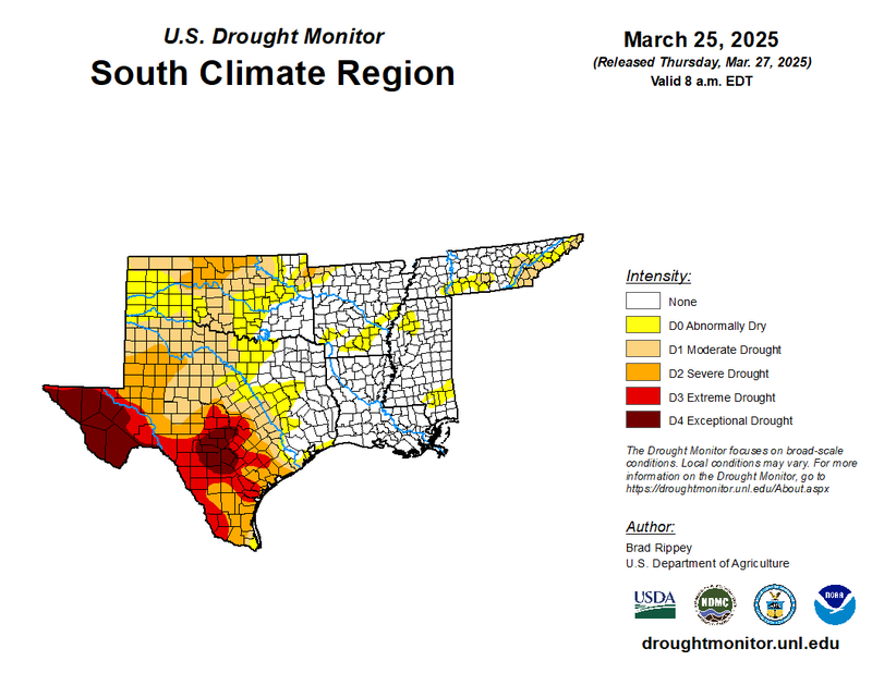
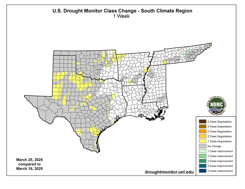
Dry conditions engulfed most of the Southern Region last week. A cold front swathed across most of the western half of the Region, bringing seasonably cooler temperatures, drier air, and gusty winds at the surface. These conditions primed the Region for fire risks. Little rainfall for weeks and strong, dry winds depleted soil moisture and dried out vegetation, creating prime fuel for wildfires. Large areas of one-classification degradation occurred in Texas, Oklahoma, and parts of Arkansas and Tennessee. As a result, over 15% of the land area became drier with (D1) Moderate Drought to (D4) Exceptional Drought conditions. Western Tennessee, however, experienced the only drought improvement. One-classification improvements occurred in several Tennessee counties, as the state was not as dry as the rest of the Region and even received moderate rainfall.
Looking forward, the Climate Prediction Center released the U.S. Seasonal Drought Outlook for the next three months. The outlook depicts a large-scale trend of persisting and developing drought for most of Texas and Oklahoma and persisting drought for southeastern Tennessee. The outlook depicts no drought for east Texas, southeast Oklahoma, Arkansas, Louisiana, Mississippi, and the western half of Tennessee.